
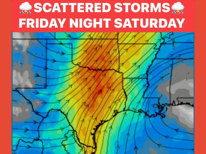
North and Central Texas to See Scattered Storms and Rain Friday Night Into Saturday as Cold Front Approaches
DALLAS, TEXAS — North and Central Texas are set to experience scattered showers and thunderstorms Friday night into Saturday as a storm system moves across the region ahead of an approaching cold front.
Meteorologists say residents should be prepared for frequent lightning, gusty winds, and isolated hail, particularly in Central Texas late Saturday afternoon and evening.
Friday Night: Storms Begin Across the Metroplex
Showers and thunderstorms are expected to develop across Dallas–Fort Worth and surrounding areas late Friday evening. The storms will bring bursts of lightning and brief periods of moderate rainfall, with a few isolated thunderstorms possible overnight.
Temperatures are expected to remain mild ahead of the front, with highs in the upper 60s to low 70s before cooler air arrives.
“Expect scattered showers with pockets of lightning, but no widespread severe threat,” one forecaster said. “Still, it’s smart to keep an eye on radar Friday night, especially if you’re traveling.”
Saturday: Rain Continues as Front Approaches
By Saturday morning, light to moderate rain will continue to spread through Central and North Texas, adding up to a trace to 1 inch of total rainfall by the end of the weekend.
Temperatures may briefly climb into the low 70s before the strong cold front moves through, bringing a quick temperature drop later in the evening.
Central Texas could also see small hail with stronger storm cells late Saturday, though the overall severe threat remains limited.
Hazards and Impacts
- ⚡ Frequent lightning during thunderstorms
- 🌧️ Rainfall up to 1 inch across the region
- 🌩️ Isolated small hail possible (mainly Central Texas)
- 💨 Wind chills expected in the teens and 20s by Sunday morning with gusts up to 30 mph
What to Expect Sunday Morning
Once the cold front sweeps through Saturday night, wind chills will plunge into the 20s across North Texas and the low 30s farther south. Gusty north winds will make conditions feel significantly colder, especially during early morning hours on Sunday.
The system marks the beginning of a cooler pattern across the state, with below-average temperatures lasting into early next week.
“This front will bring a big change in feel,” meteorologists added. “After the storms, you’ll want your jackets ready by Sunday morning.”
Stay prepared for weekend weather changes and live forecast updates at NapervilleLocal.com — your source for Texas weather news and safety alerts.

I’ve lived in Naperville long enough to see how quickly our community changes — from new developments downtown to sudden shifts in our Midwest weather. Reporting on Naperville news and daily forecasts gives me the chance to keep neighbors informed about what really matters. My goal is simple: deliver clear, timely updates so you always know what’s happening in our city and what to expect from the skies above.