
Arctic Front to Bring Light Snow and Freezing Temperatures to Western Oklahoma and Texas Panhandle on Thursday
OKLAHOMA CITY, OKLAHOMA — A surge of arctic air pushing into the Southern Plains will trigger light snow and freezing temperatures across western Oklahoma and the Texas Panhandle on Thursday, as another quick-moving winter storm system crosses the region.
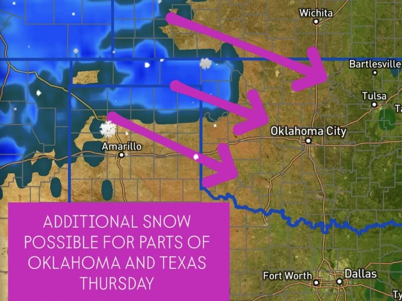
Meteorologists say the setup could bring a dusting to one inch of snow in some areas, with the potential for slick spots on roads as temperatures plunge below freezing.
Arctic Air Arrives Wednesday Night
The system begins late Wednesday as a strong arctic front sweeps through Oklahoma and Texas, ushering in a much colder air mass. Behind it, a fast-moving disturbance from the northwest will move into the Panhandles, bringing a narrow band of light snow by early Thursday morning.
The heaviest snowfall is expected across the Oklahoma Panhandle, western Oklahoma, and the Texas Panhandle, including cities such as Amarillo, Guymon, and Woodward. Farther east, flurries or light snow showers could reach Oklahoma City and north Texas, though significant accumulations are not expected.
“Another quick-moving system Thursday will bring a round of light snow,” forecasters explained. “Favored areas are the Panhandles and western Oklahoma, but it’s possible snow makes it into central and southern Oklahoma and possibly north Texas.”
Light Snow but Slick Roads Possible
While snowfall totals will remain light — generally less than one inch — road conditions could deteriorate quickly in the early hours of Thursday. With cold air already in place and surfaces below freezing, slick spots may form on bridges and overpasses.
Travelers and early commuters are urged to exercise caution, as brief bursts of snow may reduce visibility in open areas.
Bitter Cold to Follow the Snow
Behind the system, bitterly cold air will settle over Oklahoma and Texas through the weekend. Daytime highs will struggle to reach the 30s and low 40s, while overnight lows could drop into the teens and twenties.
Wind chills across the Panhandle and north-central Oklahoma may fall into the single digits Thursday night, marking one of the coldest stretches so far this season.
Forecast Updates Expected
Forecasters note that the exact placement of the snow band remains uncertain, and small shifts in the system’s track could determine how far south the snow extends. Updates over the next 24–48 hours will provide clearer timing and accumulation details.
Residents across western Oklahoma, the Panhandle region, and north Texas are advised to monitor updated forecasts and prepare for light snow, icy conditions, and a sharp temperature drop beginning Thursday morning.
For ongoing winter weather updates and radar coverage, stay connected with NapervilleLocal.com.

I’ve lived in Naperville long enough to see how quickly our community changes — from new developments downtown to sudden shifts in our Midwest weather. Reporting on Naperville news and daily forecasts gives me the chance to keep neighbors informed about what really matters. My goal is simple: deliver clear, timely updates so you always know what’s happening in our city and what to expect from the skies above.