
Colorado Snowstorm Brings Up to 8 Inches for Denver Foothills and More Than a Foot in Higher Elevations
DENVER, COLORADO — After weeks of dry conditions, Colorado is finally getting a much-needed dose of snow, blanketing the Denver metro area and surrounding mountains early this week. Forecasters say totals could reach 8 inches near the base of the foothills, while higher elevations could see a foot or more by the end of the storm.
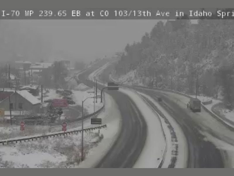
Traffic cameras along Interstate 70 near Idaho Springs showed steady snowfall and slick road conditions as plows worked to keep the mountain corridor open. The fresh snow is bringing relief to ski resorts and farmers who have been waiting for a significant winter system to boost soil moisture and snowpack levels.
Snowfall Totals Across the Region
Meteorologists with the National Weather Service in Boulder report that the system is expected to continue through late Wednesday, with the heaviest accumulations likely along the Front Range Foothills and into the Rocky Mountain high country.
Expected totals include:
- Denver and western suburbs: 5–8 inches
- Boulder and Golden foothills: 8–12 inches
- Estes Park and Nederland: 10–14 inches
- High-elevation passes (Berthoud, Loveland, and Vail): 12–18 inches or more
The snow is part of a strong Pacific storm system pulling cold, moist air over the mountains, enhancing upslope flow and creating ideal conditions for sustained snowfall.
Road and Travel Conditions
Drivers are urged to use caution, especially on I-70, Highway 285, and US 6 through Clear Creek Canyon, where snow and ice accumulation are already causing slowdowns and spinouts.
Authorities are reminding travelers that chain and traction laws remain in effect for commercial and passenger vehicles heading into mountain regions.
Road crews have been working around the clock, but visibility and slick spots remain a concern, particularly in the early morning hours.
Relief for Drought-Stricken Areas
This snowfall event is being welcomed after a drier-than-normal start to the winter season across Colorado. Meteorologists note that this system will help replenish the mountain snowpack, which is crucial for the state’s water supply come spring.
According to the latest data from the U.S. Drought Monitor, portions of central and southern Colorado remain in moderate drought, making this storm an important boost for water resources and agriculture.
More Snow Ahead?
Forecasters are monitoring another potential system moving into the state early next week. While not as strong as the current storm, it could bring additional light to moderate snow, helping maintain snowpack momentum heading into mid-December.
For now, residents across Denver, Boulder, and the mountain towns are celebrating the long-awaited return of snow — a promising sign that winter has finally arrived in full force.
Stay informed on regional weather and travel advisories at NapervilleLocal.com.

I’ve lived in Naperville long enough to see how quickly our community changes — from new developments downtown to sudden shifts in our Midwest weather. Reporting on Naperville news and daily forecasts gives me the chance to keep neighbors informed about what really matters. My goal is simple: deliver clear, timely updates so you always know what’s happening in our city and what to expect from the skies above.