
Washington and Oregon Mountain Passes to See Significant Snow as Levels Drop to 2,000 Feet Tuesday Night
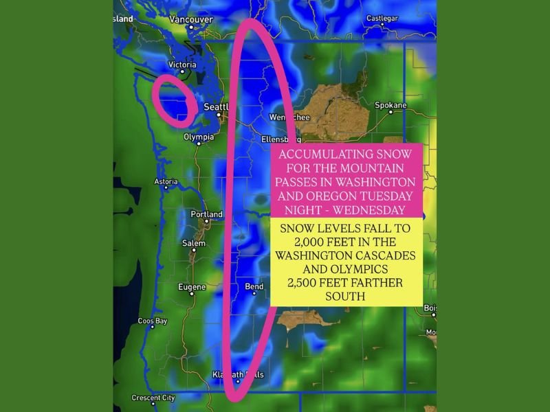
WASHINGTON — A strong early-season winter system will bring substantial mountain snow to the Cascades and Olympics beginning Tuesday night, with snow levels dropping sharply to around 2,000 feet by Wednesday morning. The same system will extend into Oregon, where accumulating snow is expected at 2,500 feet and above farther south.
Snow Levels Plunge Overnight Into Wednesday
Forecast models show a notable cooldown across the region as colder air filters in late Tuesday. According to the provided outlook, snow levels will fall to 2,000 feet in the Washington Cascades and Olympics, increasing the likelihood of hazardous driving conditions through the mountain passes.
In Oregon, snow levels will be slightly higher but still impactful, dropping to around 2,500 feet, particularly for the central and southern Cascades. This shift dramatically increases the coverage of areas that may see accumulating snow.
Mountain Passes Expected to Become Snow-Covered
The map highlights several high-travel corridors where snowfall could affect visibility and traction. Substantial snowfall is possible for:
- Washington Cascades
- Olympic Mountains
- Oregon Cascades from Bend to Klamath Falls
Travelers planning to cross these passes on Wednesday should expect winter-like road conditions and rapidly changing weather.
Officials emphasize that mountain snow, especially during the morning hours, can create sudden hazardous stretches due to elevation changes along the highways.
Benefits and Risks: Snow Helps Resorts but Flooding Concerns Remain
While this storm brings challenges for drivers, it also offers good news for mountain resorts, which rely on early-season snowfall to build base coverage. The additional snowpack may also help ease some flooding risks, though the post notes that flooding is still a significant concern in certain parts of the region.
Cold air settling into the mountains could help stabilize water levels temporarily, but recent wet patterns mean that saturated soils and rivers remain sensitive to new precipitation.
Travelers Urged to Check Pass Reports
With accumulating snow expected from Tuesday night into Wednesday, those traveling over the passes should:
- Check updated forecasts Tuesday evening
- Review pass reports before departure
- Allow extra travel time
- Carry chains or traction devices where required
Officials warn that even modest snowfall can significantly slow traffic across mountain corridors, especially during morning commute hours.
Looking Ahead
Conditions are expected to improve later Wednesday as the system moves eastward, but lingering snow showers could continue at higher elevations.
Stay with NapervilleLocal.com for updates as Washington and Oregon mountain conditions evolve during this winter storm setup.

I’ve lived in Naperville long enough to see how quickly our community changes — from new developments downtown to sudden shifts in our Midwest weather. Reporting on Naperville news and daily forecasts gives me the chance to keep neighbors informed about what really matters. My goal is simple: deliver clear, timely updates so you always know what’s happening in our city and what to expect from the skies above.