
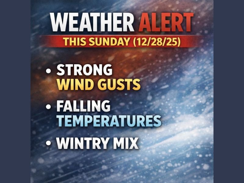
Iowa Expected to See Rapid Temperature Drop, Strong Winds, and Wintry Mix Sunday as Fast-Moving Storm System Arrives
IOWA — A fast-moving storm system is expected to impact Iowa from late Saturday into Sunday, bringing rain, sharply falling temperatures, strong wind gusts, and a transition to wintry precipitation across much of the state. With post-holiday travel underway, officials urge drivers to stay weather-aware and prepare for rapidly changing road conditions.
Rain Expected Late Saturday Before Temperatures Drop Quickly Sunday
Rain will begin developing late Saturday night into early Sunday, especially across southern Iowa, before spreading northward as the system moves through. Meteorologists note that early Sunday morning may actually be the warmest part of the day, with temperatures set to drop steadily once the cold front pushes across the state.
By late Sunday morning and afternoon, the warm air will give way to much colder conditions, setting the stage for winter weather.
Rain-to-Wintry Mix Transition Likely as Arctic Air Arrives
As colder air filters into Iowa Sunday, rain is expected to transition to a brief wintry mix, which may include:
- Rain and sleet
- Light freezing rain
- Isolated snowflakes
Forecasters emphasize that any ice formation is expected to be light and short-lived, occurring mainly on elevated surfaces such as bridges, ramps, and untreated secondary roads.
By Sunday afternoon and evening, the precipitation will change to light snow statewide. Snow totals are expected to remain modest, ranging from a dusting to 1–2 inches.
Gusty Northwest Winds May Reduce Visibility and Create Travel Issues
Behind the cold front, northwest winds will strengthen significantly, with gusts reaching 35–40+ mph. While snowfall amounts remain low, the combination of strong gusts and light snow may reduce visibility at times, especially in rural and open areas.
Even minor snow accumulation can be blown across roads, contributing to slick patches and occasional drifting.
Drivers should be particularly cautious during the afternoon and evening hours, when the wintry mix and falling temperatures overlap.
Travelers Urged to Plan Ahead as Conditions Change Quickly
With many Iowans returning home after the holiday week, the timing of the system may impact both local and long-distance travel. Officials recommend:
- Checking updated forecasts before heading out
- Allowing extra time for slower travel
- Watching for slick bridges, ramps, and untreated roads
- Being prepared for sudden drops in visibility due to wind-blown snow
While the system is not expected to be severe, the rapid shift from mild to wintry conditions could create unexpected hazards for unprepared drivers. For continuing coverage of Iowa’s weather changes, storm alerts, and travel updates, stay connected with NapervilleLocal.com.

I’ve lived in Naperville long enough to see how quickly our community changes — from new developments downtown to sudden shifts in our Midwest weather. Reporting on Naperville news and daily forecasts gives me the chance to keep neighbors informed about what really matters. My goal is simple: deliver clear, timely updates so you always know what’s happening in our city and what to expect from the skies above.