
Seattle Records Its Second Freeze of the Season as Temperatures Drop to 31 Degrees and More Cold Mornings Loom
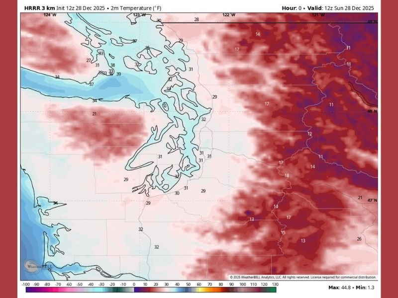
SEATTLE, WASHINGTON — Seattle woke up to its second official freeze of the season as temperatures dropped to 31 degrees early Sunday morning, matching the coldest reading recorded on November 30. According to forecasters, if not for that earlier freeze, this would have been the latest first freeze on record by nearly a full week, highlighting how unusually mild much of the early winter season has been.
The drop to freezing occurred under clearing skies, which allowed nighttime temperatures to fall sharply without cloud cover to trap warmth. Some areas around Joint Base Lewis-McChord even reported freezing drizzle and dense morning fog, especially as readings hovered near 30 degrees.
Clear Skies Bring Freeze, Fog, and a Rare Late-Season Chill
Forecasters noted that the freeze arrived as a direct result of clearer skies overnight, which often lead to colder morning lows this time of year. Patchy fog developed in several low-lying communities, creating pockets of reduced visibility and localized slick spots where freezing drizzle formed.
Sunday’s sunshine offered a brief break from the chill, but this weather pattern is expected to repeat itself over the next several days. With high pressure holding strong across the Pacific Northwest, light overnight freezes and partly sunny afternoons are likely through Monday, Tuesday, and Wednesday. Afternoon highs will generally remain in the low to mid-40s, keeping conditions seasonably cool but manageable.
Calm Weather Expected for New Year’s Festivities
Despite the cold mornings, forecasters say Seattle’s New Year’s Eve plans should remain calm and weather-friendly. There are no major storms expected before the calendar flips, making this one of the quieter holiday periods in recent years.
Light fog and freezing temperatures may still occur overnight, but daytime conditions should stay mostly sunny to partly cloudy. True precipitation chances do not return until Thursday afternoon, when the fringes of an approaching storm system begin brushing the region from the south.
Weather Pattern Turns ‘More Active’ After the Holiday
Meteorologists expect a noticeable shift as the region moves into next weekend. While no alarming storms are currently projected, the pattern begins trending “more active,” signaling a return to typical Seattle winter conditions. This includes lowland rain, mountain snow, and cloudy skies—the familiar setup residents have come to expect each January.
Ski resorts may finally receive the fresh snowfall they have been waiting for, as early-season La Niña conditions have failed to materialize. Instead, forecasters jokingly refer to it as “La Impostora,” given the lack of impactful cold air and limited snowfall so far.
Cold Air Has Struggled to Reach Seattle This Winter
Weather experts note that cold air has frequently appeared in long-range forecasts throughout December, typically showing up 10–15 days out. However, each potential push of Arctic air has weakened before reaching western Washington, resulting in a warmer and more stable pattern than expected.
Even now, there is still no strong indication of deep cold returning before mid-January. If the current trends hold, residents may need to wait until February for another chance at lowland snowfall, although long-range confidence remains low. For now, Seattle’s recent freeze serves as a reminder that winter is slowly strengthening, even if major cold air outbreaks remain elusive.
As this evolving pattern continues, NapervilleLocal.com will monitor Seattle’s temperature trends, fog development, and upcoming storm chances to keep readers updated on changing winter conditions across the Pacific Northwest.

I’ve lived in Naperville long enough to see how quickly our community changes — from new developments downtown to sudden shifts in our Midwest weather. Reporting on Naperville news and daily forecasts gives me the chance to keep neighbors informed about what really matters. My goal is simple: deliver clear, timely updates so you always know what’s happening in our city and what to expect from the skies above.