
Tennessee Weather Alert: Heavy Rain Monday Could Bring Flash Flooding Across The Mid-South
MEMPHIS, TN — The National Weather Service in Memphis is warning residents across West Tennessee and the Mid-South to prepare for periods of heavy rainfall and possible flash flooding beginning Monday morning and lasting through the evening hours.
Level 2 Flash Flood Risk Issued
According to the Weather Prediction Center, much of West Tennessee, Northeast Arkansas, and North Mississippi has been placed under a Level 2 (Slight Risk) for excessive rainfall — meaning localized flash flooding is possible in urban areas, small creeks, and low-lying roads.
Forecasters expect rain to begin shortly after 7 a.m. Monday, with the heaviest showers developing by midday and continuing into the afternoon. Rainfall totals could reach 2 to 3 inches in some locations.
Cities At Greatest Risk
Areas most likely to experience flash flooding include Memphis, Jonesboro, Dyersburg, and Paragould, while surrounding communities such as Clarksdale, Oxford, and Jackson fall under a Level 1 (Marginal Risk) for heavy rainfall.
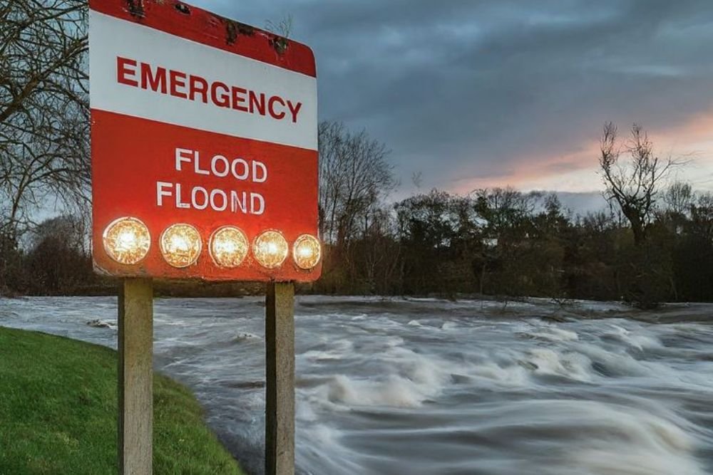
Officials urge drivers to remain cautious during the morning and evening commutes, warning that flooded roads may become impassable. The National Weather Service reminds residents:
“Turn around, don’t drown — never attempt to cross flooded roadways.”
System Moves East Overnight
Meteorologists expect rain chances to taper off late Monday night as the weather system moves east. However, additional rounds of rain could return by midweek, depending on how quickly the cold front clears the region.
Tuesday will bring cooler, cloudy conditions across the Mid-South, with highs in the low 70s before gradual warming returns later in the week.
How To Stay Alert
Residents are advised to keep multiple ways to receive weather alerts, including NOAA radios and mobile apps, and to monitor the latest forecasts for any updated flood advisories.
Do you live in Tennessee or northern Mississippi and rely on local forecasts to plan your workweek? Share your weather updates and photos with us at NapervilleLocal.com, where we bring you the latest coverage on regional weather and safety alerts.

I’ve lived in Naperville long enough to see how quickly our community changes — from new developments downtown to sudden shifts in our Midwest weather. Reporting on Naperville news and daily forecasts gives me the chance to keep neighbors informed about what really matters. My goal is simple: deliver clear, timely updates so you always know what’s happening in our city and what to expect from the skies above.