
Pennsylvania Braces for Another Cold Winter Day as Light Snow Targets Northern Areas Early This Week
PENNSYLVANIA – Cold winter conditions continue across the state Sunday, January 4, as high temperatures remain locked in the low 20s to low 30s, accompanied by partly to mostly cloudy skies, according to the latest forecast data. Any lingering overnight snow showers, mainly across eastern Pennsylvania, are expected to taper off by 7–8 a.m., while northwestern Pennsylvania could still see isolated flurries due to very weak remnant lake-effect activity.
Cold but Quiet Winter Conditions Dominate Sunday
Despite the chilly temperatures, forecasters indicate no major travel or weather issues for most of the state on Sunday. Conditions are expected to remain stable through the day, making it a typical cold winter setup rather than an impactful storm system. High temperatures shown on the map range from the low 20s in northern and western Pennsylvania to the low-to-mid 30s across central and southeastern areas, including Harrisburg, York, Reading, and Philadelphia.
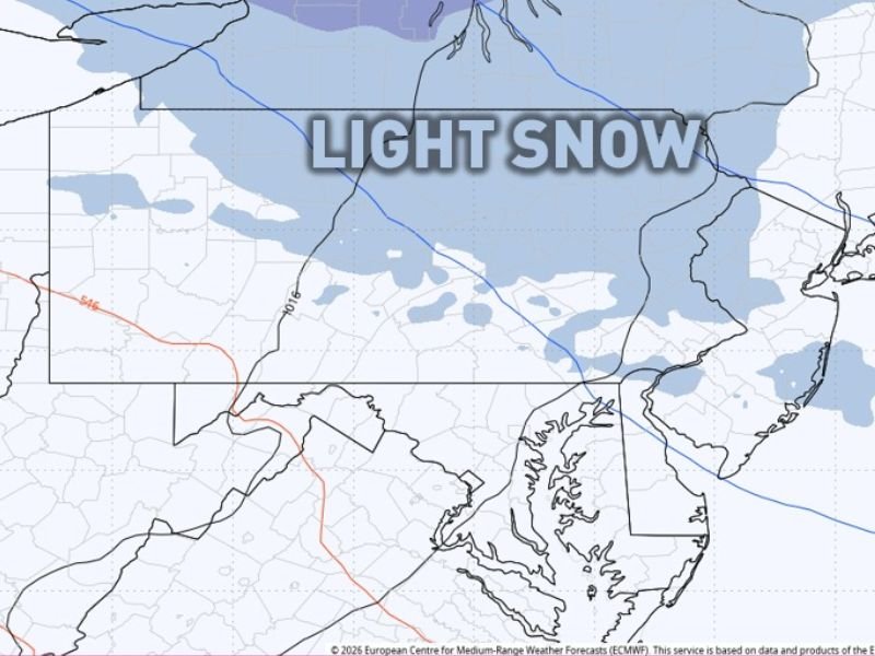
Next Weather System Brings Light Snow Monday
Attention then turns to the next weak weather system, expected to move in Monday morning through the evening, primarily affecting the northern half of Pennsylvania.
Forecast guidance suggests light snow, with most locations seeing a dusting to around one inch at most. While minor lake enhancement is possible, meteorologists note that snow totals appear limited and impacts should remain minimal.
Brief Ice Risk Followed by Milder Pattern Midweek
After Monday’s system moves out, there is a low-end risk for light icing Tuesday evening, mainly across far northern Pennsylvania. However, temperatures are expected to turn milder from Wednesday through Saturday, providing a temporary break from the persistent cold.
A more notable pattern change is anticipated toward the end of next weekend and into the second week of January, which could bring additional weather shifts. NapervilleLocal.com will continue tracking national and regional weather patterns that signal broader winter trends and potential impacts.

I’ve lived in Naperville long enough to see how quickly our community changes — from new developments downtown to sudden shifts in our Midwest weather. Reporting on Naperville news and daily forecasts gives me the chance to keep neighbors informed about what really matters. My goal is simple: deliver clear, timely updates so you always know what’s happening in our city and what to expect from the skies above.