
Isolated Storms Expected Overnight Wednesday From Texas to Oklahoma as Storm Threat Shifts Toward Mississippi by Friday
TEXAS AND OKLAHOMA – Isolated thunderstorms are expected to develop late Wednesday night into early Thursday, with rain and non-severe storm chances increasing across parts of Texas and Oklahoma, according to the latest forecast outlook. The activity is expected to remain scattered initially, but the overall storm pattern will continue to evolve as the system pushes eastward later in the week.
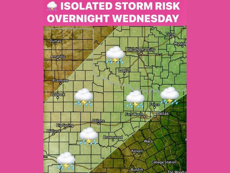
Storm Chances Increase Wednesday Night Into Thursday
Forecast data shows rain and isolated thunderstorms expanding Wednesday night, particularly across north and central Texas into Oklahoma. At this stage, storms are expected to remain non-severe, though lightning and brief downpours are possible in affected areas.
Cities shown within the impacted zone include portions of north Texas, central Oklahoma, and surrounding regions, where overnight storm coverage may become more noticeable.
Storm Threat Shifts East Late Week
By late Thursday into Friday, the storm threat is expected to shift eastward into the Southeast, as the system advances. The Storm Prediction Center (SPC) has already highlighted a slight risk for severe storms in Mississippi on Friday, signaling a higher potential for stronger storms as the system matures. This eastward progression marks a transition from isolated activity to a more organized storm setup later in the week.
What This Pattern Signals Going Forward
While Texas and Oklahoma face mainly isolated and non-severe storms, areas farther east may see increasing storm intensity as the system interacts with warmer and more unstable air.
Residents in the Southeast are encouraged to stay alert for updated forecasts as storm chances and severity increase heading into Friday. NapervilleLocal.com will continue tracking this evolving weather pattern and provide updates as new information becomes available.

I’ve lived in Naperville long enough to see how quickly our community changes — from new developments downtown to sudden shifts in our Midwest weather. Reporting on Naperville news and daily forecasts gives me the chance to keep neighbors informed about what really matters. My goal is simple: deliver clear, timely updates so you always know what’s happening in our city and what to expect from the skies above.