
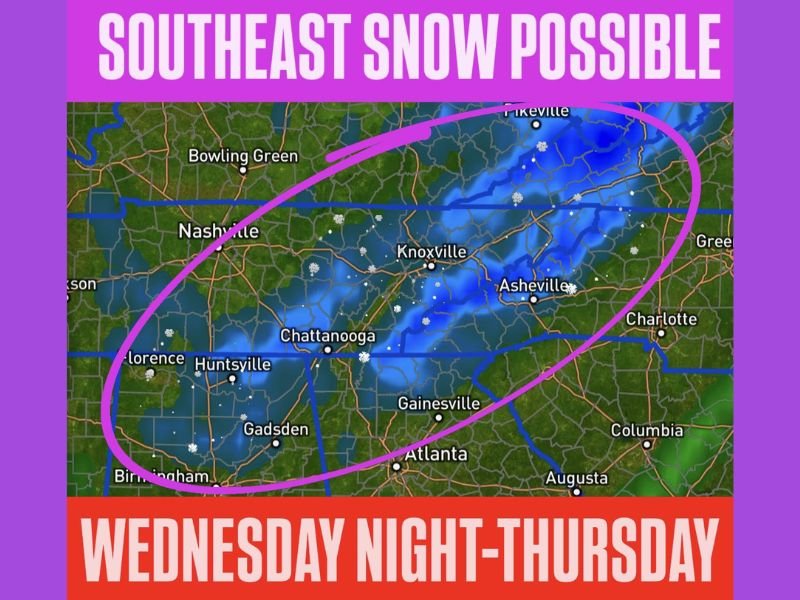
Georgia, Alabama, and Tennessee Face Light Snow Risk Wednesday Night Into Thursday as Arctic Front Pushes Cold Air South
SOUTHEAST UNITED STATES — A reinforcing Arctic front is expected to sweep through the region late Wednesday, setting up a short-lived window for light snowfall across parts of Georgia, Alabama, and Tennessee from Wednesday night into early Thursday morning. Forecast data shows cold air arriving quickly behind the front, allowing precipitation to fall as snow in select areas.
This is not shaping up to be a major winter storm, but localized accumulations are possible, particularly in higher-elevation locations.
Smoky Mountains Most Likely to See Accumulating Snow
The Great Smoky Mountains remain the most favored area for snowfall as cold air and lingering moisture overlap behind the front. In these higher elevations, light snow accumulations are likely, with some spots seeing enhanced totals due to terrain effects. Snow showers may continue for several hours overnight before tapering off early Thursday as drier air moves into the region.
Northern Georgia, Alabama, and Tennessee May See Up to an Inch in Spots
Beyond the Smokies, higher terrain in northern Georgia, northeastern Alabama, and eastern Tennessee could see up to around one inch of snow in isolated areas. Lower elevations and major metro areas are more likely to experience flurries or brief snow showers with little or no accumulation.
Even light snow could lead to slick bridges and elevated roadways, especially during the early Thursday morning commute.
Narrow Time Window for Snow Impacts
The primary timeframe for snow is late Wednesday night through early Thursday morning, coinciding with the coldest air arriving behind the Arctic front. Temperatures are expected to slowly rebound later Thursday, allowing any remaining snow showers to end quickly. While widespread travel disruptions are not anticipated, residents in higher elevations should remain cautious overnight.
Why This Setup Is Worth Watching
Snowfall in the Southeast is often highly dependent on elevation and timing, and even minor events can create localized issues due to limited winter weather infrastructure. This system highlights how quickly Arctic air can change precipitation types across the region.
NapervilleLocal.com will continue tracking winter weather signals across the country and break down what they mean as conditions evolve.

I’ve lived in Naperville long enough to see how quickly our community changes — from new developments downtown to sudden shifts in our Midwest weather. Reporting on Naperville news and daily forecasts gives me the chance to keep neighbors informed about what really matters. My goal is simple: deliver clear, timely updates so you always know what’s happening in our city and what to expect from the skies above.