
The Cold, Hard Truth: Why Sunday Snow in Florida and the Southeast Is Possible — But Far From Guaranteed
SOUTHEASTERN UNITED STATES — Snow remains technically on the table this weekend for parts of the Southeast and Florida, but the reality is far more complicated than a simple yes-or-no forecast. While several models continue to hint at flurries or brief snow showers early Sunday, temperature profiles — especially near the ground — remain the biggest obstacle.
This will not be a repeat of last year’s event. Moisture will be present, and cold air will be nearby, but getting everything to line up at the same time remains a challenge.
Why Temperatures Are the Biggest Problem
The most under-discussed issue in this setup is Sunday morning surface temperatures. While snow can fall with air temperatures slightly above 32°F, accumulation requires near-freezing ground temperatures, and that is where confidence drops.
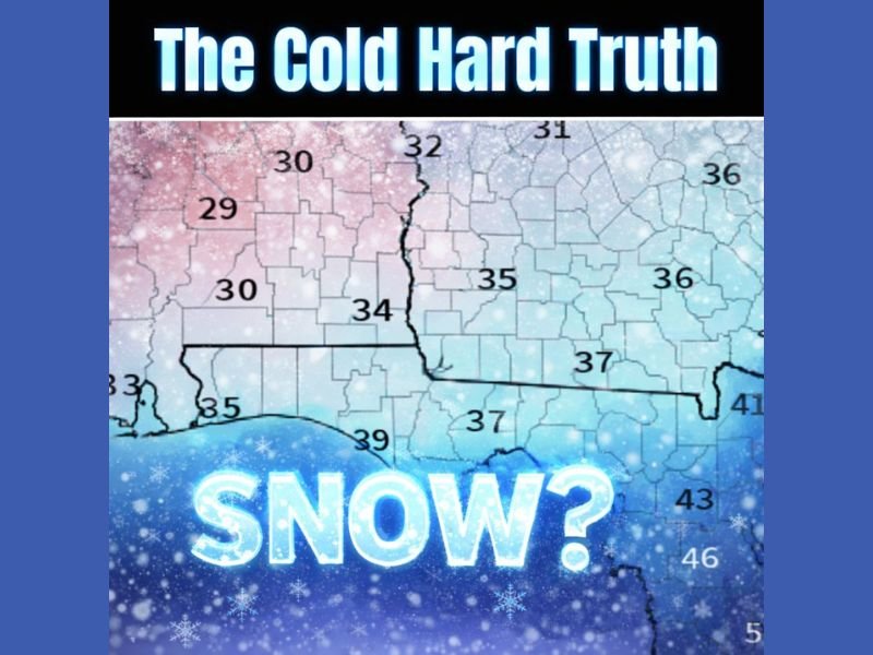
Current blended guidance shows:
- Many areas hovering in the mid-30s
- Ground temperatures still holding residual warmth
- A narrow window where colder air briefly overlaps with moisture
This means snow may fall, but sticking will be difficult, especially outside elevated or shaded areas.
What the Models Are Really Saying
Despite the hurdles, models have not backed off completely, which is why this setup continues to get attention. Key takeaways from Sunday morning blended model data:
- Light snow or flurries remain possible
- Accumulation would be limited and highly localized
- Moisture availability is not the issue
- Timing of colder air arrival is critical
In short, this is a “thread-the-needle” scenario, where small changes make a big difference.
Why This Isn’t Hype — But Isn’t a Bust Either
This forecast lives in the uncomfortable middle ground:
- Not cold enough for confidence
- Not warm enough to dismiss entirely
Meteorologists are watching for:
- Slight downward adjustments in morning temperatures
- Faster cold air advection
- Any overnight trend toward colder surface readings
Until those changes appear, expectations remain cautious.
The Bottom Line
Snow chances are real but fragile across parts of the Southeast and Florida this weekend. Flurries are plausible, brief snow showers are possible, but meaningful accumulation remains unlikely unless temperatures trend colder overnight.
Hope is still alive — but realism matters. For continued winter weather updates, model trend breakdowns, and clear explanations without hype, keep following coverage at NapervilleLocal.com.

I’ve lived in Naperville long enough to see how quickly our community changes — from new developments downtown to sudden shifts in our Midwest weather. Reporting on Naperville news and daily forecasts gives me the chance to keep neighbors informed about what really matters. My goal is simple: deliver clear, timely updates so you always know what’s happening in our city and what to expect from the skies above.