
Winter Storm Fern Expands Nationwide as Arctic Air and Baja Low Combine to Drive Snow and Ice from New Mexico to New England
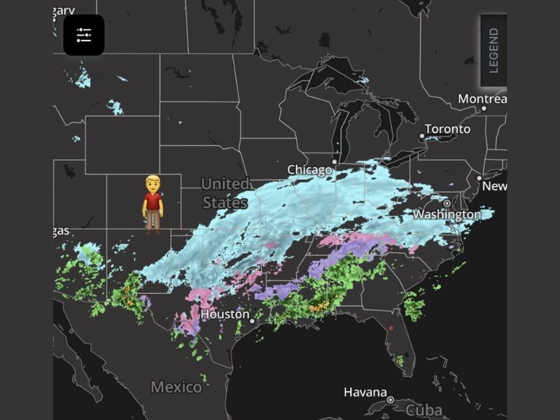
UNITED STATES — A powerful and complex winter system known as Winter Storm Fern is taking shape across the southern and central United States as deep arctic air collides with a Baja low moving eastward, fueled by an active subtropical jet stream. The evolving setup is expected to produce a long, continuous corridor of snow, sleet, freezing rain, and rain stretching from the Southwest to the Northeast, with impacts lingering into Monday.
Why This Storm Is Spreading So Far
Meteorologists are closely watching this system because it combines several strong atmospheric ingredients:
- Arctic air plunging southward from the Plains and Midwest
- A Baja low ejecting across northern Mexico and the southern U.S.
- A moist, energized subtropical jet supplying widespread precipitation
When these elements merge, the result is a broad and slow-moving winter storm capable of affecting multiple regions simultaneously.
Snow and Ice Corridor Identified
Based on current radar and model guidance, winter precipitation is expected to extend across a wide swath of the country, including:
- New Mexico and West Texas, where snow and mixed precipitation are already developing
- Texas, Arkansas, and the Lower Mississippi Valley, where sleet and freezing rain are likely near the cold-warm boundary
- Tennessee, Kentucky, and the Ohio Valley, where heavy snow may dominate north of the ice zone
- Mid-Atlantic states into New England, where snow is expected to persist and linger into Monday
The storm’s scale makes it one of the more expansive winter events of the season so far.
Ice and Rain South of the Snow Line
South of the heaviest snow band, warmer air aloft is overriding surface-level cold air, creating a dangerous ice threat in parts of:
- East Texas
- Louisiana
- Mississippi
- Alabama
- Georgia and the Carolinas
These areas are likely to see freezing rain and sleet, with rain farther south toward the Gulf Coast.
Chicago and Midwest Implications
While the heaviest precipitation core remains south and east of Chicago, the Midwest sits near the northern edge of the storm, where lighter snow bands and lingering cold air may still create impacts, especially as the system exits toward the Northeast.
Cold temperatures will persist even after precipitation ends, increasing the risk of refreezing and hazardous travel conditions.
Why Impacts Could Last Into Monday
Winter Storm Fern is not expected to move quickly. Its elongated structure and interaction with the jet stream may allow snow and ice to continue well after the main system passes, particularly across the Ohio Valley, Mid-Atlantic, and New England. Travel disruptions, power outages in ice-prone areas, and prolonged cold conditions remain possible.
Have you seen winter weather impacts where you live yet, or are you preparing for what’s coming next? Share your observations and stay with NapervilleLocal.com for continued tracking and clear updates as Winter Storm Fern unfolds.

I’ve lived in Naperville long enough to see how quickly our community changes — from new developments downtown to sudden shifts in our Midwest weather. Reporting on Naperville news and daily forecasts gives me the chance to keep neighbors informed about what really matters. My goal is simple: deliver clear, timely updates so you always know what’s happening in our city and what to expect from the skies above.