
Colorado and Southern Wyoming Brace for Significant Mountain Snow as Grand Junction, Aspen, and Continental Divide Face Up to 2 Feet
COLORADO — A late-night winter storm is pushing east into Colorado and parts of southern Wyoming, bringing a mix of rain and snow to lower elevations and significant snowfall to the high country through Thursday morning. Forecasters say this system is just the beginning, with another round of active weather expected by Friday.
Western Slope Sees Rain/Snow Mix While Mountains Pile Up Accumulation
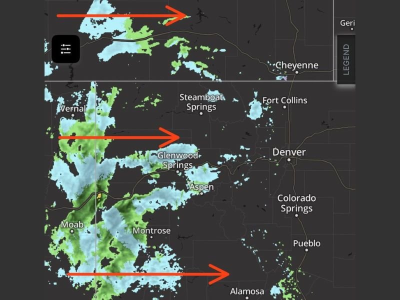
Lower elevations along Colorado’s Western Slope are seeing a combination of rain and wet snow, especially around Grand Junction, Rangely, and Montrose. Through Wednesday, snowfall totals in these lower areas are expected to range from a trace up to around 2 inches. As elevation increases, however, impacts grow much more substantial.
Communities in and around the mountain valleys — including areas near Aspen and Glenwood Springs — could see snowfall totals approaching a foot by Thursday morning. Travel through these corridors may become increasingly difficult, particularly overnight and during early morning hours.
12 to 18 Inches Above 10,000 Feet
Snowfall amounts are forecast to increase dramatically above 10,000 feet. At those elevations, 12 to 18 inches of snow is possible before the system winds down.
The highest peaks along and west of the Continental Divide could see locally up to two feet of snow. This includes rugged terrain stretching through central and western Colorado, where colder air and orographic lift will enhance totals.
Mountain passes and high-elevation roadways are likely to experience hazardous conditions, including reduced visibility and snow-covered pavement.
Southern Wyoming Also Impacted
Portions of southern Wyoming are also being affected as the storm advances eastward. While the heaviest snow is expected in Colorado’s high terrain, areas near the Wyoming border may see accumulating snowfall, particularly in elevated locations. Travelers heading north toward Cheyenne or west toward the high country should monitor conditions closely.
Another Storm Already on Deck for Friday
Even as this system continues through Thursday morning, another storm is lining up for Friday. That means the break between systems may be brief, especially in the mountains where snowpack will continue to build. Back-to-back storms could compound impacts for ski areas, mountain communities, and high-elevation travel corridors.
Drivers are encouraged to check official road condition resources before heading out, especially in mountain terrain where conditions can deteriorate quickly. For continued coverage of major weather events impacting states across the country, stay updated with NapervilleLocal.com.

I’ve lived in Naperville long enough to see how quickly our community changes — from new developments downtown to sudden shifts in our Midwest weather. Reporting on Naperville news and daily forecasts gives me the chance to keep neighbors informed about what really matters. My goal is simple: deliver clear, timely updates so you always know what’s happening in our city and what to expect from the skies above.