
Quarter-Size Hail and 60 MPH Wind Threat Target Alabama Friday Night Into Saturday as Storm System Intensifies
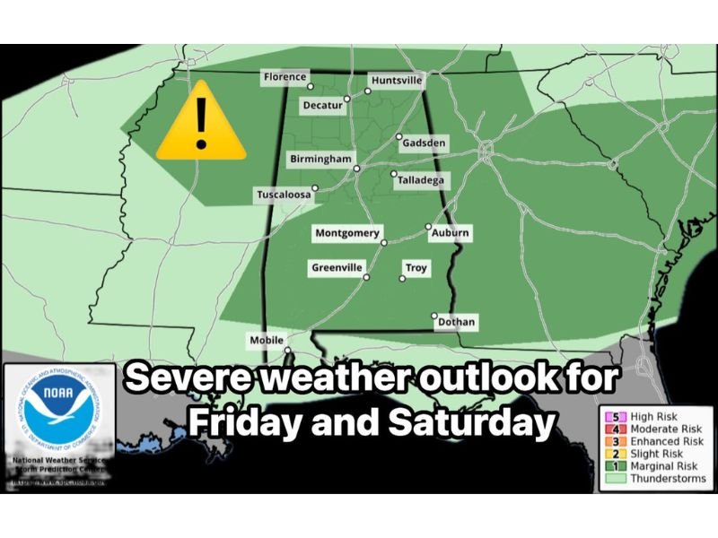
ALABAMA — The Storm Prediction Center has outlined a low-level severe weather threat beginning Friday night and continuing through Saturday afternoon (February 20–21), with quarter-sized hail, wind gusts over 60 mph, heavy rain, and frequent lightning all possible across much of the state.
Forecasters emphasize that while this is not currently a high-end outbreak, conditions will be favorable for scattered strong to severe thunderstorms.
Risk Area Covers Much of Central and Northern Alabama
The highlighted outlook area includes cities such as:
- Florence
- Huntsville
- Decatur
- Gadsden
- Birmingham
- Tuscaloosa
- Montgomery
- Auburn
- Talladega
- Greenville
- Troy
- Dothan
- Mobile
The severe risk shading covers a broad portion of central and northern Alabama, signaling that storms developing in this region could produce hail and damaging wind gusts.
Main Hazards: Hail and Damaging Winds
According to the outlook details, the primary concerns include:
- Quarter-sized hail
- Wind gusts exceeding 60 mph
- Heavy rainfall
- Frequent lightning
While tornado risk is not the main focus in this setup, strong wind fields could allow isolated stronger storms to briefly intensify.
Storm Timeline: Friday Night Into Saturday Afternoon
The storm timeline indicates the system will move through in waves:
- 12 AM – 7 AM Saturday: Storms move into northwestern Alabama, affecting areas such as Florence, Haleyville, and Jasper.
- 5 AM – 11 AM Saturday: Activity spreads into west-central areas including Tuscaloosa, Birmingham, and surrounding communities.
- 9 AM – 3 PM Saturday: Storms shift toward central and southeastern Alabama, including Montgomery, Auburn, Alexander City, and surrounding counties.
The heaviest rain and strongest storms are expected Saturday morning through early afternoon before gradually exiting.
Heavy Rain and Lightning Could Cause Travel Disruptions
Beyond hail and wind, heavy downpours may create localized ponding on roads, especially during the morning commute hours Saturday. Frequent lightning could also accompany stronger storm cells.
Residents should monitor forecast updates and be prepared for changing weather conditions overnight into Saturday. For continued severe weather coverage and regional updates, stay with NapervilleLocal.com as this system develops.

I’ve lived in Naperville long enough to see how quickly our community changes — from new developments downtown to sudden shifts in our Midwest weather. Reporting on Naperville news and daily forecasts gives me the chance to keep neighbors informed about what really matters. My goal is simple: deliver clear, timely updates so you always know what’s happening in our city and what to expect from the skies above.