
Florida Weather Whiplash: Saturday Brings 80s–90s Heat, Then Tuesday Morning Wind Chills Crash Into the 20s in a 50–60 Degree Swing
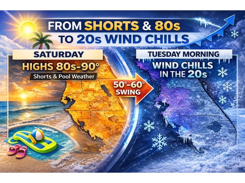
FLORIDA — Florida is staring down a dramatic temperature flip that will take the state from shorts-and-pool weather on Saturday to winter-feeling wind chills by Tuesday morning. Forecast messaging shows highs in the 80s to near 90 degrees Saturday, followed by a powerful push of colder air that could drive wind chills into the 20s early Tuesday, marking a stunning 50 to 60 degree swing in just a few days.
The graphic and accompanying text describe it plainly: residents who are running air conditioning and complaining it is “too hot for February” on Saturday may be digging hoodies back out by Tuesday morning. This is a classic Florida pattern when a strong front arrives after a brief surge of heat and humidity.
Saturday: 80s to 90 Degrees and “Pool Weather” Conditions
Saturday’s setup is positioned to feel more like late spring or early summer across many Florida communities. The forecast highlights highs in the 80s to 90 degrees, which is warm enough for beach days, outdoor events, and heavy air-conditioning demand.
Even without specific city-by-city numbers in the graphic, the statewide message is clear: much of Florida will be on the warm side of the front first. This can also mean higher humidity, especially closer to the coastline and in the peninsula, where the marine influence supports muggy air.
Tuesday Morning: Wind Chills in the 20s After a Sharp Cold Push
By Tuesday morning, the pattern flips hard. The same forecast highlights wind chills in the 20s, which is a major shock for residents who just experienced near-90-degree heat days earlier. Wind chills this low usually imply a combination of colder air and persistent wind behind the front.
This type of setup tends to create the most discomfort early in the morning hours when temperatures bottom out and wind is still elevated. Even if actual air temperatures stay above freezing in many areas, cold wind chills can still create real impacts for outdoor workers, students waiting at bus stops, and anyone without adequate layering.
What a 50–60 Degree Swing Can Impact
Fast swings like this can cause practical problems because people and property are not prepared for both extremes within the same long weekend.
Residents should think about:
- Clothing and outdoor plans: Warm weekend outfits may not work for Tuesday morning commutes
- Pets: Outdoor animals may need shelter once colder air arrives
- Plants: Sensitive landscaping can be stressed when temperatures drop sharply, even without a hard freeze
- Energy demand: Air conditioning use can quickly shift back to heating needs in some homes
What to Do Next
Florida residents should take advantage of the warm stretch but plan now for the cold snap. The biggest takeaway is timing: summerlike heat Saturday, then a rapid drop with very cold-feeling mornings by Tuesday.
For more weather updates written in a clear, straightforward format, visit NapervilleLocal.com.

I’ve lived in Naperville long enough to see how quickly our community changes — from new developments downtown to sudden shifts in our Midwest weather. Reporting on Naperville news and daily forecasts gives me the chance to keep neighbors informed about what really matters. My goal is simple: deliver clear, timely updates so you always know what’s happening in our city and what to expect from the skies above.