
Muggy Air and Rising Dewpoints Advancing Into Chicago Davenport Dayton and St Louis With Middle 60s Humidity Triggering Scattered Storms This Weekend May 16 and 17
MIDWEST — The first extended taste of summer humidity is on the way for the Midwest this weekend, with dewpoints climbing into the middle 60s advancing northward through the St. Louis, Davenport, Chicago, Fort Wayne, and Dayton corridor on May 16 and 17. This marks the region’s first significant surge of elevated humidity for the season, and the moisture increase will linger into next week.
Saturday carries the higher storm risk as the incoming humidity combines with a passing disturbance to trigger scattered thunderstorms across the region. Dayton historically averages 146 hours in May with dewpoints at or above 60 degrees, confirming that while this humidity surge feels early, it is well within the normal range for mid-May across the region.
Middle 60s Dewpoints Advancing Northward Saturday Bringing First Real Muggy Feel of the Season
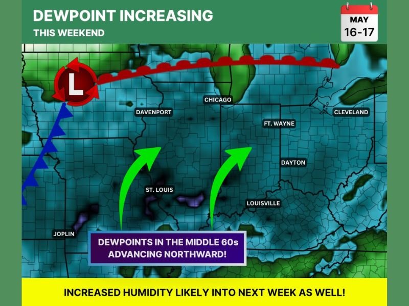
Dewpoints climbing into the middle 60s represent the threshold where most people begin to genuinely feel the mugginess in the air, and that is exactly what is advancing northward into the Midwest this weekend. The green arrows on the map show moisture surging northward from the St. Louis and Louisville corridor toward Chicago, Fort Wayne, and Cleveland through Saturday.
Saturday will carry the most noticeable humidity increase as the moisture surge peaks across the region, giving residents their first real taste of summer-like air for the 2026 season.
Saturday Disturbance Combines With Humidity to Trigger Scattered Thunderstorms
The combination of elevated dewpoints and an approaching atmospheric disturbance on Saturday creates favorable conditions for scattered thunderstorm development across the outlined zone. The higher humidity provides the fuel source while the disturbance supplies the lift needed to initiate storm activity across the Chicago, Davenport, and surrounding areas during the day.
Residents with outdoor plans Saturday should monitor radar closely and have a backup plan ready as scattered storms are possible at various times throughout the day across the region.
Humidity Dries Out Briefly Sunday Before Returning and Persisting Into Next Week
Sunday brings a partial drying trend as humidity levels pull back slightly after Saturday’s peak, but the relief is short-lived. Dewpoints continue trending upward and the increased humidity is expected to persist into next week, signaling that the brief early-season cool and dry pattern across the Midwest is giving way to a more summer-like and muggy stretch ahead.
Anyone sensitive to humidity or with health conditions affected by muggy air should begin preparing for a more persistent humid pattern settling into the region through the coming week. Stay with NapervilleLocal.com for the latest weather updates and local forecast coverage.

I’ve lived in Naperville long enough to see how quickly our community changes — from new developments downtown to sudden shifts in our Midwest weather. Reporting on Naperville news and daily forecasts gives me the chance to keep neighbors informed about what really matters. My goal is simple: deliver clear, timely updates so you always know what’s happening in our city and what to expect from the skies above.