
Large Hail Damaging Winds and Heavy Downpours Targeting Texas Including Dallas Fort Worth Houston Wichita Falls and Waco With 70 Percent Storm Coverage Tuesday Noon to 6PM
TEXAS — A significant severe weather event is expected Tuesday across Texas as an approaching cold front breaks the cap and drives widespread storms across the state with 70 percent coverage during the main timeframe of noon to 6 PM. Quarter size hail, wind gusts of 40 to 60 mph, dangerous lightning, and heavy downpours are all on the table with the strongest storms. An unsettled and active pattern then persists through Memorial Day weekend with flood watches likely in Southeast Texas by end of week.
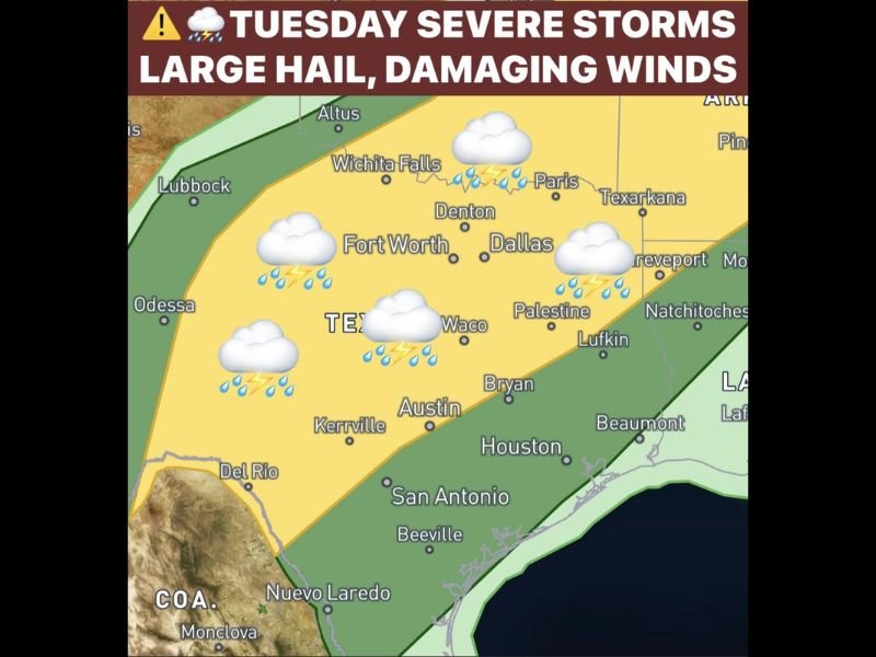
Tuesday Front Breaks Cap Driving Widespread Storms Noon to 6PM Across North and Central Texas
The approaching cold front on Tuesday breaks through the strong atmospheric cap and triggers widespread storm development across the Dallas, Fort Worth, Wichita Falls, Denton, Waco, and Paris corridor during the noon to 6 PM window. The 70 percent storm coverage represents a widespread and significant event affecting millions of Texans through the afternoon hours.
Quarter size hail and 40 to 60 mph wind gusts with the strongest cells make this a serious severe weather situation requiring full awareness Tuesday afternoon.
Heavy Downpours and Lightning Also Major Concerns Alongside Hail and Wind
Beyond hail and wind, heavy downpours and dangerous lightning are significant concerns with Tuesday’s storm activity across the outlined risk zone. Rainfall totals of 2 to 4 inches are expected statewide this week with higher totals possible across North Texas where the heaviest storm activity concentrates.
Southeast Texas including Houston and Beaumont faces an increasing flood watch threat by the end of the week as the wet pattern continues to evolve.
Active Pattern Persists Through Memorial Day Weekend With Daily Storm Chances
After Tuesday’s main event the front pushes south Wednesday bringing scattered storms, with rain and storm chances continuing literally every day through Memorial Day weekend and into next week. This multi-day active pattern will not produce all-day rain on any given day but will maintain persistent flooding concerns across Southeast Texas through the end of the month.
Residents across the entire Texas storm zone should remain weather aware through Tuesday and monitor flood watches closely heading into the weekend. Stay with NapervilleLocal.com for the latest weather updates and local forecast coverage.

I’ve lived in Naperville long enough to see how quickly our community changes — from new developments downtown to sudden shifts in our Midwest weather. Reporting on Naperville news and daily forecasts gives me the chance to keep neighbors informed about what really matters. My goal is simple: deliver clear, timely updates so you always know what’s happening in our city and what to expect from the skies above.