
Alabama Weather Shift Brings Monday Cold Snap and Possible Snow Flurries as Forecasters Dismiss Viral Claims of Major Snowstorm
BIRMINGHAM, ALABAMA — A sharp shift in weather is expected across Alabama early Monday as colder air moves into the region behind a passing storm system. While some social media posts have suggested a major snowfall could occur, meteorologists say those claims are misleading and that only light snow flurries or brief snow showers are possible in parts of the state. Forecasters emphasize that any snow Monday morning is expected to be minor and unlikely to cause significant impacts.
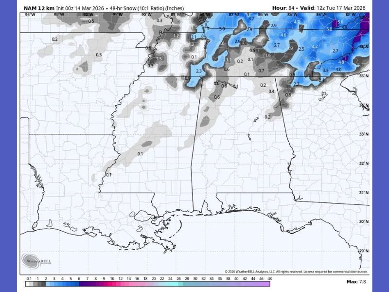
Forecasters Say Snowfall Over One Inch Is Unlikely
Weather experts say widespread snowfall accumulation across Alabama is not expected. Despite circulating online posts claiming otherwise, current forecast data indicates the state is not likely to see more than an inch of snow. If snow does occur Monday morning, it will most likely appear as scattered flurries or brief snow showers, primarily across northern Alabama.
Because temperatures have recently reached the 70s and even 80s in parts of the region, the ground remains warm. That warmth makes it difficult for snow to accumulate unless precipitation becomes much heavier than currently forecast.
Northern Alabama Most Likely to See Flurries
Forecast models suggest the best chance for snow flurries will occur across northern sections of the state. Cities including Huntsville, Florence, Decatur, and areas near the Tennessee border could see occasional flurries as colder air filters into the region Monday morning.
However, forecasters say these snow showers would likely be brief and light, with little to no accumulation expected. Some higher elevations could briefly see a dusting, but even there impacts are expected to remain minimal.
Cold Air Becomes the Main Weather Concern
Meteorologists say the biggest story behind the system will not be snow, but the sudden arrival of much colder air. After experiencing unusually warm temperatures recently, Alabama is expected to experience a sharp temperature drop early in the week.
That change could create risks for sensitive plants and early-season vegetation that may have begun growing during the recent warm spell. Experts recommend residents take steps to protect plants and outdoor vegetation from the colder conditions.
Winter’s Brief Return May Be Short-Lived
The incoming cold air mass appears likely to bring only a short-lived taste of winter. Forecast models suggest the colder temperatures will move through quickly, meaning any snow flurries that do develop would also be short-lived. Meteorologists say the situation continues to evolve, but current data indicates the event will remain minor compared with winter storms typically seen farther north.
Residents Encouraged to Watch Forecast Updates
Weather officials are urging residents across Alabama to follow reliable forecast updates and avoid misinformation circulating on social media. At this time, the most likely scenario remains a cold snap with occasional flurries Monday morning and little to no snow accumulation. Forecasters say they will continue monitoring model trends and provide updates if the forecast changes as the cold air system approaches.

I’ve lived in Naperville long enough to see how quickly our community changes — from new developments downtown to sudden shifts in our Midwest weather. Reporting on Naperville news and daily forecasts gives me the chance to keep neighbors informed about what really matters. My goal is simple: deliver clear, timely updates so you always know what’s happening in our city and what to expect from the skies above.