
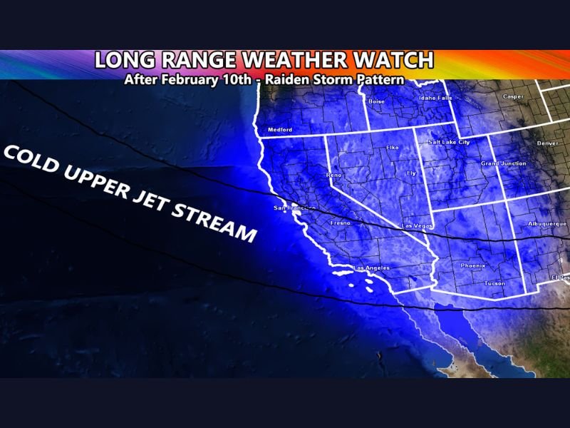
California Long-Range Weather Watch Warns of Colder, Wetter Storm Pattern After Feb. 10 With Snow Levels 5,000–6,000 Feet
CALIFORNIA — A long-range weather watch issued for Southern California warns that an offshore flow pattern this week may give way to a colder storm setup beginning around February 10, followed by an even more moisture-loaded system around mid-month. The advisory frames the change as a return to “storms returning,” after a quieter stretch, and points to a colder upper-jet-stream pattern that could keep systems coming into the second half of February.
What the long-range watch is signaling
The watch indicates the current pattern—described as offshore flow—is expected to shift toward a more active storm track. Offshore flow often brings drier, warmer, or windier conditions depending on setup, but the watch suggests that won’t hold. Instead, it highlights a transition toward cold and wet storms arriving, with the first meaningful change arriving around the 10th and continuing into the middle of the month.
First system around Feb. 10: colder air with limited moisture
The first storm in the pattern is described as sliding in around February 10 and characterized as a northwest slider system. The watch notes it does not carry a lot of moisture, but still matters because it introduces colder air and helps establish the broader storm pattern that follows.
For this first system, the watch projects snow levels between 5,000 and 6,000 feet. That range is important for mountain travel and pass impacts, even if the storm is not a major rain producer at lower elevations.
Second system around Feb. 15: the one to watch for pass-level snow
The bigger concern comes mid-month, around February 15, when the watch says a second, colder system could arrive with more moisture and colder air. The advisory describes this as the storm that could bring pass-level snowfall, meaning impacts could extend beyond the highest peaks into more travel-critical elevations.
This second system is framed as the more consequential event because it combines the two ingredients that matter most for widespread winter impacts: cold air and available moisture.
Why the pattern could last into Feb. 19–20
The watch suggests there is a good chance the mid-month shift could open the door to multiple systems, potentially continuing as the calendar approaches February 19 and 20. While it does not claim certainty on exact storm-by-storm impacts at that range, the overall message is persistence: once the colder track sets in, it may not be a one-and-done event.
What to take away right now
The guidance emphasizes timing and trend rather than specifics: offshore flow now, a colder change near Feb. 10, and a more moisture-rich system around Feb. 15 that could create the most notable snow impacts—especially near mountain passes.
If you’re tracking winter pattern shifts and storm timing across the U.S., share what you’re seeing and join the conversation at NapervilleLocal.com.

I’ve lived in Naperville long enough to see how quickly our community changes — from new developments downtown to sudden shifts in our Midwest weather. Reporting on Naperville news and daily forecasts gives me the chance to keep neighbors informed about what really matters. My goal is simple: deliver clear, timely updates so you always know what’s happening in our city and what to expect from the skies above.