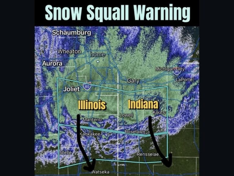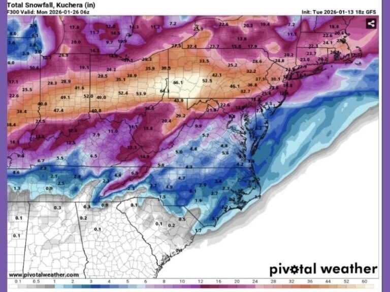
Long-Range GFS Model Shows Extreme Snowstorm Scenario Across Midwest and Ohio Valley — But Confidence Is Extremely Low
MIDWEST / OHIO VALLEY — A striking long-range weather model image circulating online is showing a theoretical, high-impact snowstorm across large portions of the Midwest and Ohio Valley, with snowfall totals that would be historic if they ever became reality. However, meteorologists are strongly emphasizing that this scenario is more than 240 hours away and…