
Florida Snow Talk Returns as Forecast Models Flag Rare Ocean-Effect Setup From Gainesville to Tampa Bay
FLORIDA — Forecast models are cautiously signaling a rare and highly conditional chance for snowflakes across parts of the state this weekend, as an unusual ocean-effect weather pattern briefly develops behind a surge of Arctic air.
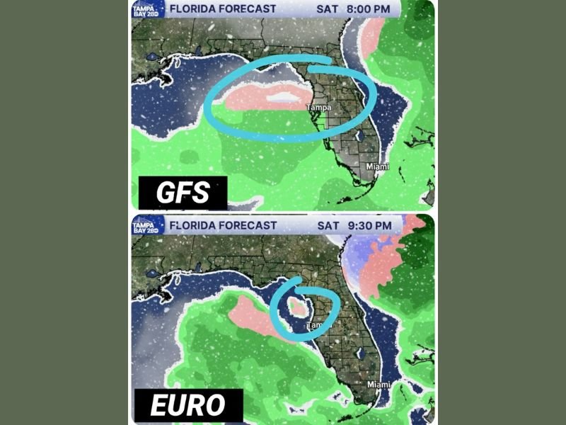
Overnight runs of the GFS and EURO models are now leaning into a setup where very cold air moves over comparatively warmer Gulf waters, creating just enough instability for precipitation to briefly mix with snow. While seeing accumulating snow in Florida remains a long shot, meteorologists say the “window of opportunity” for flakes has narrowed but is no longer zero.
When the Best Opportunity Exists
The most favorable timing appears to be after 6 PM Saturday through Sunday morning, when colder air deepens across the region. During this period, surface temperatures are expected to hover near the lower threshold needed for frozen precipitation, especially during overnight hours.
Even slight changes in temperature or precipitation intensity could determine whether flakes fall or the event stays entirely rain. The setup is expected to be brief, with conditions quickly becoming less favorable after sunrise Sunday.
Where Flurries Are Most Likely
Model guidance places the highest, though still limited, chance from Gainesville south toward Highway 60, with the best odds west of Interstate 75. This zone benefits from favorable wind direction pulling Gulf moisture inland while colder air remains in place near the surface.
Areas closer to Tampa Bay appear near the southern edge of the setup, where precipitation could briefly mix with snow before changing back to cold rain. Locations farther south, including South Florida, are expected to remain too warm for frozen precipitation.
Why Accumulation Is Unlikely
Despite the attention, forecasters stress that this is still Florida. Ground temperatures remain warm, surface air is marginal, and precipitation rates are expected to stay light. Any snowflakes that do fall would melt on contact, resulting in zero accumulation.
Most areas experiencing precipitation will see a cold rain or rain-snow mix, with snow limited to brief, localized bursts if it occurs at all.
Why This Setup Is Getting Attention
What makes this event notable is the rare alignment of atmospheric ingredients needed for Florida snow. Ocean-effect precipitation requires precise timing, cold air depth, wind direction, and moisture — factors that rarely come together this far south.
The fact that both major forecast models are independently highlighting this scenario has increased interest, even as confidence in measurable snow remains very low.
Florida residents are advised to manage expectations while staying alert for forecast updates. Even without snow, this event will bring unusually cold temperatures for the region. For continued coverage of significant national weather patterns and their impacts, visit NapervilleLocal.com for the latest updates.

I’ve lived in Naperville long enough to see how quickly our community changes — from new developments downtown to sudden shifts in our Midwest weather. Reporting on Naperville news and daily forecasts gives me the chance to keep neighbors informed about what really matters. My goal is simple: deliver clear, timely updates so you always know what’s happening in our city and what to expect from the skies above.