
Freezing Rain and Sleet Sweep Across Central and Eastern North Carolina Before Turning to Rain as Temperatures Plunge Overnight
NORTH CAROLINA — A late-evening band of sleet and freezing rain moved through central and parts of eastern North Carolina, creating slick road conditions before gradually transitioning to plain rain as the system encountered warmer air closer to the coast.
Meteorologists noted this was the final band associated with the storm, marking the end of a highly unusual winter system that brought mixed precipitation rather than widespread snow or ice accumulation.
Sleet and Freezing Rain Affect Inland Communities
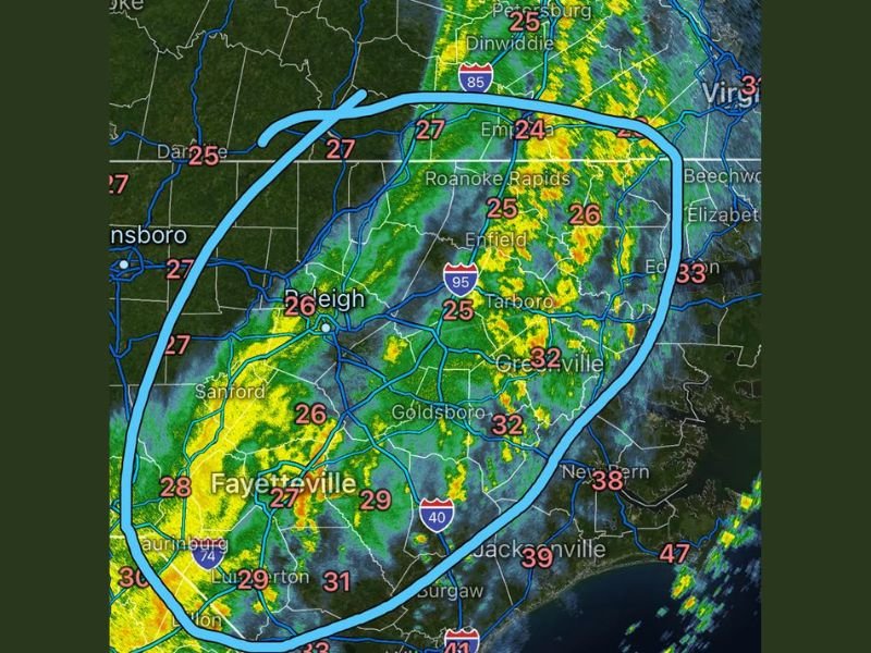
Radar imagery shows pockets of sleet and freezing rain impacting areas including Raleigh, Fayetteville, Sanford, Goldsboro, Tarboro, Roanoke Rapids, and Enfield, with surface temperatures hovering in the mid-20s to near-freezing range.
As the system progressed eastward, warmer air aloft caused precipitation to change to rain, particularly near Greenville, Jacksonville, and coastal counties, helping limit the severity of icing farther east.
Power Outages Avoided, but Road Hazards Remain
Despite early concerns, forecasters confirmed that the worst-case scenario for power outages and heavy sleet accumulation was avoided. However, road conditions remain hazardous, especially in inland and northern areas where freezing rain briefly accumulated. Drivers are urged to use caution, as wet roads may appear harmless but can quickly refreeze once temperatures drop.
Temperatures Expected to Drop Sharply Overnight
As skies begin to clear behind the storm, temperatures across most of North Carolina are expected to fall into the teens and single digits overnight, setting the stage for widespread refreezing.
Any moisture left on roads, bridges, and sidewalks that does not melt before nightfall is likely to refreeze, creating dangerous conditions during the morning commute.
A Rare and Unusual Winter Setup
Meteorologists described this storm as highly unusual, combining freezing rain, sleet, temperature swings, and a rapid changeover to rain—a setup rarely seen across the state.
While the storm is exiting, its impacts will linger, especially with cold air returning quickly behind the system. Residents are encouraged to remain cautious, limit overnight travel, and stay alert for black ice conditions early tomorrow.
Have you experienced slick roads or freezing rain in your area tonight? Share your local conditions and stay updated with continued weather coverage at NapervilleLocal.com.

I’ve lived in Naperville long enough to see how quickly our community changes — from new developments downtown to sudden shifts in our Midwest weather. Reporting on Naperville news and daily forecasts gives me the chance to keep neighbors informed about what really matters. My goal is simple: deliver clear, timely updates so you always know what’s happening in our city and what to expect from the skies above.