
Frost Advisory Issued for Tampa, Orlando and Surrounding Central Florida Areas Wednesday Morning as Temperatures Drop Overnight
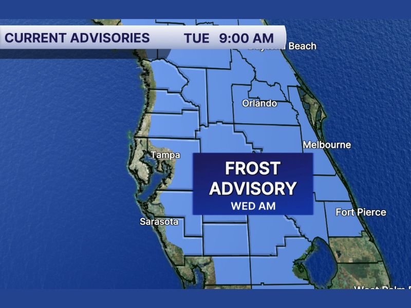
FLORIDA — A Frost Advisory has been issued for portions of central Florida, including areas around Tampa, Orlando, Sarasota, Melbourne, and Fort Pierce, as temperatures are expected to dip enough early Wednesday morning to allow frost formation.
The advisory covers much of inland central Florida, highlighted in blue on the latest advisory map. With winds expected to decrease overnight, conditions will become more favorable for frost to develop before sunrise Wednesday.
Where Frost Is Most Likely
The advisory area stretches across interior sections of the state, including:
- Tampa Bay region
- Orlando metro area
- Inland communities near Sarasota
- Areas west of Melbourne
- Portions near Fort Pierce
When winds calm overnight, cold air can settle near the ground — especially in rural and low-lying areas — increasing the risk of patchy frost.
Why Frost Is Developing
Frost typically forms under clear skies, light winds, and cool temperatures. With the recent cold air mass in place and winds expected to decrease late Tuesday night, surface temperatures may fall low enough to allow frost to form on exposed surfaces.
While Florida is known for its mild winters, interior sections can still experience brief frost events during strong cold snaps.
Protecting Plants and Sensitive Vegetation
Residents in the advisory zone are urged to take precautions, particularly if they have sensitive plants or early spring vegetation. Recommended actions include:
- Covering outdoor plants overnight
- Bringing potted plants indoors
- Protecting exposed irrigation systems
- Covering delicate landscaping
Frost can damage flowers, young vegetable plants, and tropical species that are not cold-tolerant.
What to Expect Wednesday Morning
The greatest frost potential will occur during the early morning hours Wednesday, before sunrise. Once the sun rises and temperatures climb, frost should quickly dissipate.
Drivers may notice patchy frost on grassy areas and rooftops, though widespread roadway icing is not expected. Temperatures are forecast to gradually moderate after this cold spell, reducing frost risks later in the week.
Residents across central Florida should prepare Tuesday evening to protect vulnerable plants and stay informed on any updates to the advisory. For continued national weather coverage and regional alerts, stay connected with NapervilleLocal.com.

I’ve lived in Naperville long enough to see how quickly our community changes — from new developments downtown to sudden shifts in our Midwest weather. Reporting on Naperville news and daily forecasts gives me the chance to keep neighbors informed about what really matters. My goal is simple: deliver clear, timely updates so you always know what’s happening in our city and what to expect from the skies above.