
Illinois, Indiana, Michigan, Wisconsin and Ohio Enter Active Late-February Pattern With Multiple Snow, Rain and Mix Chances Feb. 23–28
ILLINOIS — A more active late-February weather pattern is shaping up across the Great Lakes and Midwest, with forecast messaging signaling multiple precipitation chances from Feb. 23 through Feb. 28, 2026. The broad setup includes Illinois, Indiana, Michigan, Wisconsin, and Ohio, where several systems may move through in quick succession, keeping snow, rain, and mixed precipitation all in play.
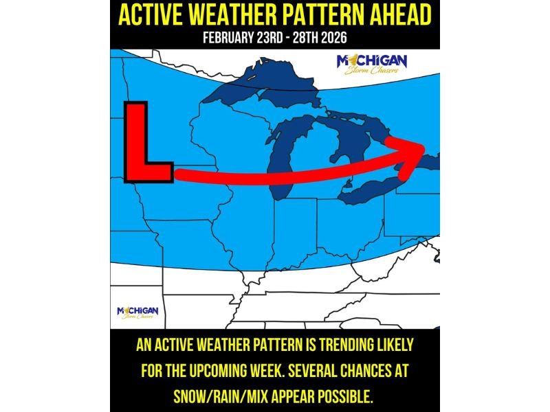
While it remains too early to determine exact snowfall totals or pinpoint the strongest system, the overall signal is clear: the region is heading into a stretch of unsettled weather as the month winds down.
What an “Active Weather Pattern” Means for the Region
An active pattern typically involves repeated low-pressure systems tracking across the Midwest and Great Lakes. Instead of a quiet, stable stretch, communities may see precipitation every day or two as disturbances pass through.
For the states highlighted — Illinois, Indiana, Michigan, Wisconsin, and Ohio — that can translate into frequent changes in road conditions, fluctuating visibility, and quick temperature swings. Even small variations in storm track can shift the heaviest precipitation north or south.
Snow, Rain and Mix All on the Table
Late February systems often bring competing air masses. If milder air arrives first, precipitation can begin as rain before colder air wraps in and changes it to snow. In other cases, areas closer to Lake Michigan or farther north may remain cold enough for snow while southern counties see a mix.
Mixed precipitation can be especially tricky. Rain and snow combinations can create slushy roads that later refreeze overnight if temperatures dip below freezing. That’s why even moderate systems can produce travel impacts when timing overlaps with morning or evening commutes.
Timing Window: Feb. 23–28
The period from February 23 through February 28 is highlighted as the active stretch. Rather than one single major storm, the setup suggests multiple waves moving through the region. Each disturbance may bring its own precipitation type and intensity, depending on how temperatures evolve day by day.
Residents should monitor:
- Daily forecast updates for timing refinements
- Overnight lows that may lead to refreeze
- Potential wind shifts behind passing systems
- Changes in precipitation type during events
What Residents Should Do Now
With several precipitation chances possible across Illinois, Indiana, Michigan, Wisconsin, and Ohio, flexibility will be important. Allow extra travel time on days when precipitation is expected and stay alert for rapidly changing conditions.
As late February often delivers surprise swings, even minor systems can have outsized local impacts. For continuing updates and region-focused coverage, visit NapervilleLocal.com.

I’ve lived in Naperville long enough to see how quickly our community changes — from new developments downtown to sudden shifts in our Midwest weather. Reporting on Naperville news and daily forecasts gives me the chance to keep neighbors informed about what really matters. My goal is simple: deliver clear, timely updates so you always know what’s happening in our city and what to expect from the skies above.