
Indiana Faces Elevated Flooding Risk This Week as 1–3 Inches of Rainfall Expected Statewide, With Some Areas Near Indianapolis and Fort Wayne Approaching 4–5 Inches
INDIANA — A prolonged stretch of wet weather is setting up across the Hoosier State, with excessive rainfall possible through the week as multiple storm systems track along a stalled frontal boundary.
Forecast guidance indicates all of Indiana is expected to receive between 1 and 3 inches of rainfall over the next 7 to 8 days, with some localized areas potentially picking up 4 to 5 inches. The repeated rounds of rain raise concerns for ponding on roads, runoff issues and possible flooding in low-lying or poor-drainage areas.
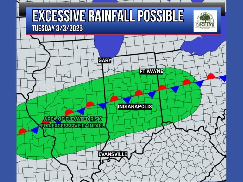
Elevated Risk Zone Includes Indianapolis and Fort Wayne
An area of elevated risk for excessive rainfall stretches across central Indiana, including Indianapolis, and extends northeast toward Fort Wayne. The corridor also spans westward and southwest toward portions of the state closer to the Illinois border.
While cities such as Gary in northwest Indiana and Evansville in the southwest are expected to see steady rainfall as well, the central band near Indianapolis appears to be a focal point for repeated heavier rounds.
The risk zone is aligned along a stationary frontal boundary, which is expected to act as a track for incoming storm systems throughout the week.
Rounds of Moderate to Heavy Rainfall
Instead of a single storm event, Indiana will likely experience multiple rounds of moderate to heavy rainfall, particularly beginning Tuesday and continuing periodically through the week.
When a front stalls across a region, storms can repeatedly move over the same areas. This process can lead to increasing soil saturation and a higher potential for runoff and localized flooding.
Urban centers such as Indianapolis are especially vulnerable to rapid ponding on streets during heavier downpours. Smaller creeks and drainage systems may also rise more quickly if rainfall totals approach the higher end of projections.
Flooding and Roadway Safety Concerns
With rainfall totals potentially reaching 4 to 5 inches in isolated areas, officials are urging caution around flooded roadways. Even shallow water across roads can be dangerous, particularly at night or during heavy rain.
Drivers are reminded to turn around and avoid driving through flooded areas, as water depth and roadway conditions beneath the surface may be difficult to judge.
As the week progresses, updated rainfall projections may adjust depending on how individual storm systems track along the boundary.
Residents across Indianapolis, Fort Wayne, Evansville, Gary and surrounding communities should monitor local forecasts and prepare for a persistently wet pattern. For continuing updates on heavy rainfall threats and regional weather developments, visit NapervilleLocal.com for the latest coverage.

I’ve lived in Naperville long enough to see how quickly our community changes — from new developments downtown to sudden shifts in our Midwest weather. Reporting on Naperville news and daily forecasts gives me the chance to keep neighbors informed about what really matters. My goal is simple: deliver clear, timely updates so you always know what’s happening in our city and what to expect from the skies above.