
Indiana Faces Fog, Rain, Gusty Winds, and Possible Snow as Two Weather Systems Target Late Week
INDIANA — After a brief stretch of calm and relatively uneventful weather, conditions across Indiana are turning more active again this week as a shifting atmospheric pattern brings fog, rain, gusty winds, and the renewed possibility of winter weather by the weekend.
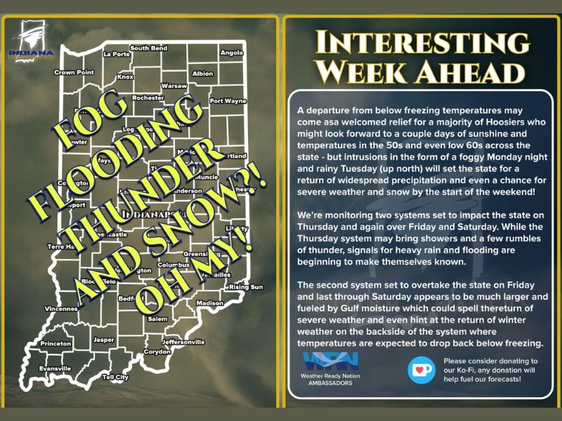
Forecasters say Monday serves as a transition day, with the atmosphere “waking back up” and setting the stage for multiple weather systems that could impact travel, outdoor plans, and daily routines statewide.
Fog and Temperature Swings Begin the Week
Monday starts with temperatures climbing into the low 40s to mid and upper 50s, depending on location, creating a sharp contrast compared to recent colder mornings. However, this warmth will be short-lived. Overnight temperatures are expected to dip back near or below freezing, a setup that significantly increases the risk for dense fog, particularly across northern Indiana.
Low visibility may linger into the Tuesday morning commute, prompting drivers to allow extra time and use caution on roadways. School transportation and early travel plans could also be affected in fog-prone areas.
Tuesday Brings More Warmth and Rain
By Tuesday, temperatures climb another notch, reaching upper 40s to low 60s statewide. Along with the warmer air, rain chances increase, especially along and north of US-30, marking a return to more widespread precipitation.
While the rain is not expected to be severe, it is welcomed in many areas still dealing with ongoing drought conditions. Forecasters note the rain should be steady enough to help soil moisture without posing immediate flooding concerns.
Thursday System Raises Flooding and Thunder Concerns
Attention then turns to System #1, expected to arrive Thursday. Rain is forecast to overspread much of Indiana, with isolated rumbles of thunder possible. Meteorologists are closely monitoring a corridor near the warm front and surface low where rainfall could become more efficient.
Localized heavier totals are possible, and 1 to 2 inches of rain cannot be ruled out in some areas. Where the heaviest rain sets up will depend heavily on the storm’s eventual track, which remains uncertain at this stage.
Stronger Late-Week System May Bring Snow Back
A second, more dynamic storm system is expected to follow quickly behind, impacting Indiana Friday into Saturday. This system appears stronger, fueled by Gulf moisture and capable of producing additional rain, gusty winds, and possibly stronger storms.
Once the system exits, colder air is expected to surge back in. That temperature drop opens the door for snow to re-enter the forecast, particularly on the backside of the system, reminding residents that winter is far from over.
What to Watch Going Forward
Forecast confidence will increase as newer data becomes available, but residents should prepare for rapid weather changes, including fog, wet roads, strong winds, and the potential return of wintry conditions late in the week. Officials recommend staying weather-aware and flexible with end-of-week plans as Indiana moves into a more unsettled pattern once again.

I’ve lived in Naperville long enough to see how quickly our community changes — from new developments downtown to sudden shifts in our Midwest weather. Reporting on Naperville news and daily forecasts gives me the chance to keep neighbors informed about what really matters. My goal is simple: deliver clear, timely updates so you always know what’s happening in our city and what to expect from the skies above.