
Michigan and Northwest Ohio Under Winter Weather Advisory for Freezing Rain Friday Morning, Ice Glaze Expected After 6 A.M.
Michigan — A Winter Weather Advisory has been issued for nearly the entire state of Michigan, along with Lucas, Wood, Ottawa, Sandusky, Erie, Fulton, and Williams Counties in northwest Ohio, due to freezing rain expected early Friday morning. Forecasters warn that a glaze of ice is possible after 6 a.m., creating hazardous travel conditions before gradual improvement later in the afternoon.
Freezing Rain Threat Expected to Impact Friday Morning Commutes
Weather officials indicate that freezing rain will develop during the early morning hours, particularly between 6 a.m. and late morning, as temperatures hover near or below freezing. Even a thin layer of ice can lead to dangerously slick roads, sidewalks, and elevated surfaces, significantly increasing the risk of accidents.
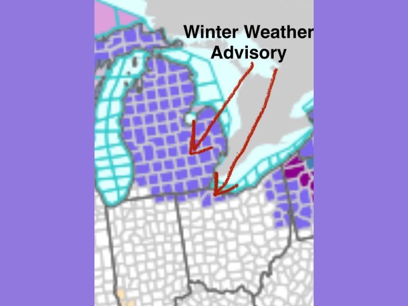
The advisory map shows widespread coverage across Michigan, with highlighted counties in Ohio also falling within the risk zone. Commuters in both states are urged to allow extra travel time, avoid sudden braking, and prepare for rapidly changing pavement conditions.
Forecasters stress that freezing rain events are especially hazardous because icy surfaces often appear wet rather than visibly frozen, causing drivers to underestimate road conditions. Bridges and overpasses are expected to ice first.
Counties Included in the Advisory and Key Weather Concerns
The advisory covers nearly all of Michigan’s lower peninsula along with several Ohio counties, including:
- Lucas County
- Wood County
- Ottawa County
- Sandusky County
- Erie County
- Fulton County
- Williams County
In these areas, even a minor ice glaze can lead to downed tree branches, slippery walkways, and potential powerline issues. While significant icing is not anticipated, the risk of scattered power disruptions cannot be ruled out. The advisory notes that conditions will improve during the afternoon, with warming temperatures reducing the threat of continued icing, especially in southern sections where improvement may occur sooner.
What Residents Should Do Before and During the Advisory
Residents in the affected counties should take several safety precautions:
- Check travel routes before leaving home
- Use caution on untreated roads and avoid speeding
- Keep emergency supplies in vehicles, including blankets and ice scrapers
- Watch for falling branches if light icing accumulates
- Wear appropriate footwear to prevent slips on sidewalks
Schools and morning businesses may experience delays depending on ice formation. Officials encourage residents to monitor updates from the National Weather Service and local emergency management offices.
Looking Ahead as Conditions Improve Later in the Day
By afternoon, temperatures are expected to rise slightly, helping melt any accumulated glaze and improving road conditions across the region. However, meteorologists caution that lingering slick spots may persist in shaded areas or on untreated surfaces.
The advisory serves as an early reminder that winter weather patterns remain fully active across the Midwest, and even minor icing can disrupt travel and daily routines. For ongoing winter weather updates, local alerts, and regional forecasts, continue following NapervilleLocal.com for reliable coverage throughout the season.

I’ve lived in Naperville long enough to see how quickly our community changes — from new developments downtown to sudden shifts in our Midwest weather. Reporting on Naperville news and daily forecasts gives me the chance to keep neighbors informed about what really matters. My goal is simple: deliver clear, timely updates so you always know what’s happening in our city and what to expect from the skies above.