
Mississippi Faces Possible Freezing Temperatures as Colder Air Returns Sunday and Stronger Cold Pattern Signals Emerge by Late Next Week
MISSISSIPPI — Cold air is expected to return this Sunday, but long-range forecast signals suggest a much colder and potentially more impactful pattern could take shape across Mississippi and surrounding Southern states by the end of next week.
While meteorologists caution that it is too early to pin down exact temperatures or precipitation types, forecast guidance increasingly points toward a sustained cold setup, rather than a brief cool-down. This shift raises concerns for parts of Mississippi that are not accustomed to prolonged cold or freezing conditions.
Cold Air Begins Moving Back In on Sunday
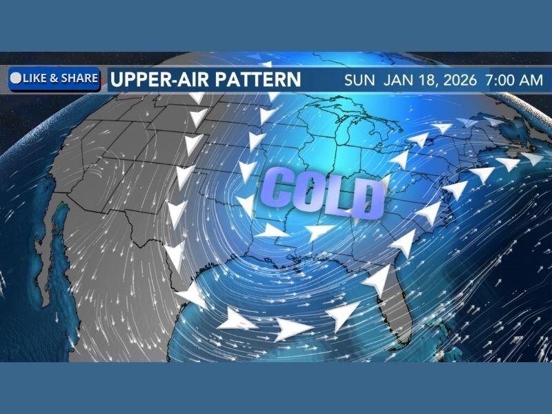
Forecast data shows that cooler air returns Sunday, marking the beginning of a broader pattern change across the central and eastern United States. Upper-air signals indicate north-to-south flow, allowing colder air to move deeper into the South. This initial push of cold air is not expected to be extreme, but it sets the stage for stronger reinforcing cold shots later in the week as the overall pattern becomes more amplified.
Late-Week Pattern Could Bring Much Colder Conditions to Mississippi
Long-range model guidance suggests that by the end of next week, a much colder air mass may become established across the Deep South, including Mississippi. Forecast discussions specifically note that freezing temperatures are possible in South Mississippi, a region where freezes are less common and can have outsized impacts. Even short periods below freezing can affect:
- Outdoor plumbing
- Sensitive vegetation
- Livestock and agriculture
- Unprotected infrastructure
The signal for cold is becoming more consistent across multiple forecast runs, which is why meteorologists are closely monitoring the situation despite the extended time frame.
Wintry Precipitation Still Uncertain at This Range
Some models have hinted at wintry precipitation, but forecasters emphasize that it is far too early to confirm snow or ice.
At this distance:
- Small shifts in storm track could change outcomes
- Temperature profiles are not yet reliable
- Cold air alone does not guarantee winter precipitation
For now, the cold itself is the primary concern, not snowfall or icing.
Why Forecast Confidence Is Limited This Far Out
Forecasts beyond 5–7 days remain sensitive to:
- Jet stream positioning
- Strength and depth of upper-level troughs
- Timing of cold air intrusions
- Interaction with Gulf moisture
Because of these variables, meteorologists stress patience and recommend watching how the pattern evolves through the coming days.
What Mississippi Residents Should Watch For
As the colder pattern develops, residents across Mississippi should stay alert for:
- Updates on potential freeze timing
- Any cold-weather advisories
- Changes in long-range temperature projections
The forecast update, posted January 9, 2026, at 9:18 p.m., makes clear that this is an evolving situation, with confidence expected to improve as the colder air draws closer. For continued weather updates and impact-focused coverage, stay with NapervilleLocal.com.

I’ve lived in Naperville long enough to see how quickly our community changes — from new developments downtown to sudden shifts in our Midwest weather. Reporting on Naperville news and daily forecasts gives me the chance to keep neighbors informed about what really matters. My goal is simple: deliver clear, timely updates so you always know what’s happening in our city and what to expect from the skies above.