
North Carolina and Virginia Could See Midday Sunday Snow Showers Dropping a Quick Coating as Bands Slide In From the Northwest
UNITED STATES — Don’t be surprised if snow showers pop up around midday Sunday across parts of North Carolina and Virginia, as a quick-moving burst of colder air and moisture slides in from the northwest. The setup is not expected to create major problems, but it’s enough of a chance that residents should be aware, especially if they’ll be driving during the brief window when snow showers are most likely.
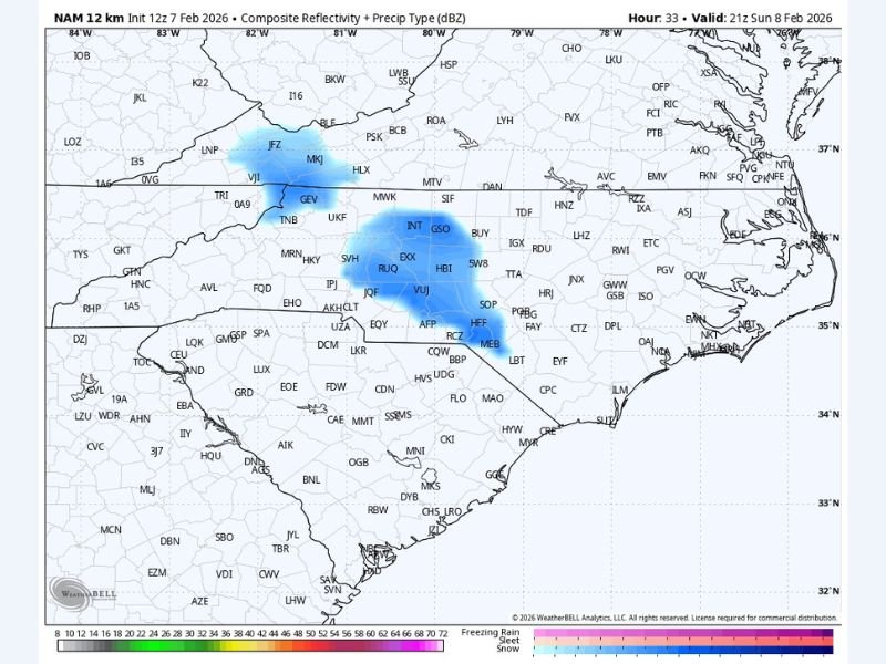
Snow Showers Expected to Be Brief, Not an All-Day Storm
The forecast messaging in the image points to a short-lived round of snow showers that could last a few hours. This is not being framed as a widespread or high-impact winter storm. Instead, it’s the type of midday “pop-in” snow that can briefly reduce visibility and create isolated slick spots, then fade.
Where the Best Chance Shows Up on the Map
The model snapshot shown (NAM 12 km) places the most organized snow-shower signal over interior sections of North Carolina and southern/central Virginia, with the focus near the Piedmont and nearby corridors rather than the far coastal plain. The map highlights a banded area of snow showers that looks most consistent around the Triad region and nearby communities, then tapering outward.
What Accumulation Looks Like: A Quick Coating for Some
The guidance shared with the graphic suggests no big accumulation for most locations, but a quick coating is possible in spots—mainly on:
- Elevated surfaces (bridges, overpasses, decks)
- Grass and colder untreated surfaces
Roads may stay mostly wet in many neighborhoods, but short bursts of snow can still make certain ramps and bridges briefly slippery.
Why This Can Still Matter for Travel
Even when totals are small, midday snow showers can cause quick trouble because they arrive fast, often during higher-traffic hours. If you get caught under a heavier shower, the most noticeable impacts are usually brief visibility drops and a sudden change in traction on colder surfaces.
Bottom Line for Sunday
This is a “heads-up” event, not a panic event. The overall message is that snow showers are possible, they should be short-lived, and impacts should remain limited—while still being worth watching if you’re out during the midday window.
NapervilleLocal.com will continue tracking notable U.S. winter swings and quick-hit snow chances that can disrupt travel even without a major storm.

I’ve lived in Naperville long enough to see how quickly our community changes — from new developments downtown to sudden shifts in our Midwest weather. Reporting on Naperville news and daily forecasts gives me the chance to keep neighbors informed about what really matters. My goal is simple: deliver clear, timely updates so you always know what’s happening in our city and what to expect from the skies above.