
Ohio Severe Weather Alert: Tornado and Large Hail Threat Increasing Tuesday Night With Damaging Winds Possible
OHIO — The risk of severe weather is increasing across parts of Ohio and the western Great Lakes region Tuesday evening, with forecasters warning that conditions could support damaging winds, large hail, and possible tornadoes as storms develop overnight.
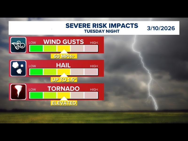
Meteorologists reviewing the latest forecast data say the environment appears increasingly favorable for multiple severe weather hazards. Updated projections now indicate that storms capable of producing 60 mph wind gusts, hail up to 1.5 inches in diameter, and isolated tornadoes may develop as the evening progresses. The growing concern has prompted forecasters to elevate the overall risk heading into Tuesday night.
Storm Threat Increasing Tuesday Evening
Weather models suggest thunderstorms could begin organizing during the evening hours before intensifying as they move through the region overnight.
The main threats expected with these storms include:
- Damaging wind gusts exceeding 60 mph
- Large hail up to 1.5 inches
- An elevated tornado risk
Forecasters say the combination of atmospheric instability and strengthening storm development could allow thunderstorms to become severe quickly once they form.
Multiple Severe Hazards Possible
While strong winds appear to be one of the most widespread threats, meteorologists are also watching closely for storms capable of producing significant hail.
Hailstones around 1.5 inches in diameter are possible in the strongest storm cores, which could cause damage to vehicles, roofs, and outdoor property. Additionally, the tornado threat has been described as elevated, meaning a few storms may develop rotation capable of producing tornadoes if atmospheric conditions align.
Timing Focused on Tuesday Night
The severe weather risk is expected to increase during the evening and nighttime hours, when storms are most likely to develop and intensify.
Nighttime storms can sometimes pose additional challenges because severe weather may occur when many residents are asleep. Meteorologists emphasize the importance of having multiple ways to receive weather alerts, especially overnight.
Residents Urged to Monitor Forecast Updates
Although the exact track and intensity of storms will become clearer closer to the event, forecasters say the overall setup suggests the potential for a notable severe weather episode Tuesday night. Residents across the region are encouraged to stay updated with the latest forecasts and be prepared in case warnings are issued.
Keeping weather alerts enabled, identifying safe shelter locations, and monitoring local radar updates can help ensure people are ready if storms begin to intensify Tuesday evening.

I’ve lived in Naperville long enough to see how quickly our community changes — from new developments downtown to sudden shifts in our Midwest weather. Reporting on Naperville news and daily forecasts gives me the chance to keep neighbors informed about what really matters. My goal is simple: deliver clear, timely updates so you always know what’s happening in our city and what to expect from the skies above.