
Oklahoma and Arkansas Brace for Freezing Drizzle, Heavy Sleet, and Early-Morning Snowfall Along I-40 Corridor
TULSA, OKLAHOMA — New weather data released late Wednesday indicates a potentially hazardous night ahead for parts of Oklahoma and northwest Arkansas, where freezing drizzle, sleet, and snow are forecast to develop before dawn. Meteorologists warn that conditions could quickly deteriorate overnight, leading to slick roads and travel disruptions across Green Country and the I-40 corridor.
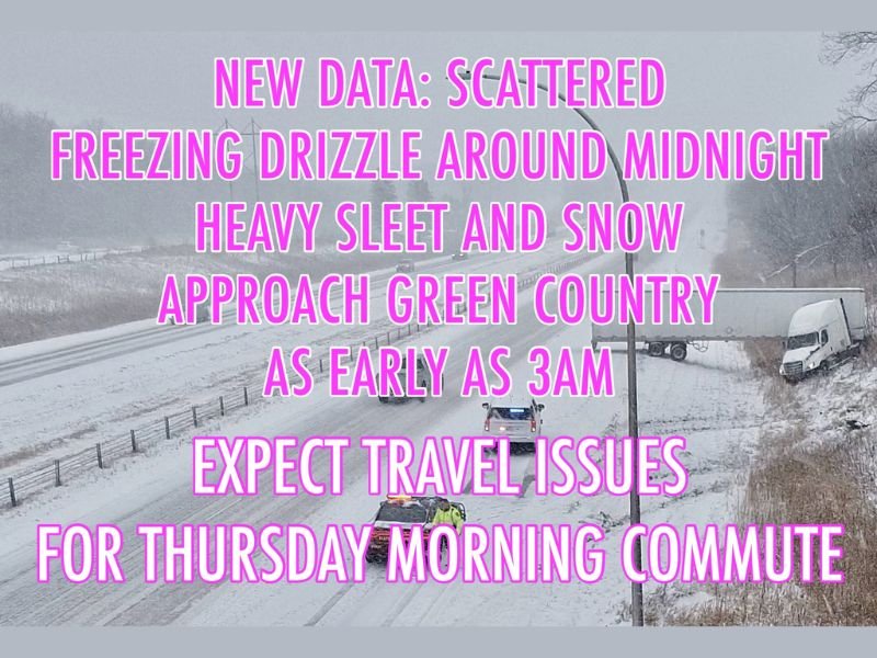
According to short-range forecast models, light freezing drizzle is expected to begin around midnight, followed by a band of heavy sleet and snow moving in from western Oklahoma toward Tulsa and the surrounding region as early as 3 a.m. Thursday.
The latest models also suggest the possibility of localized snow accumulation along the I-40 corridor — particularly from El Reno to Muskogee — where temperatures are expected to hover near freezing.
Dangerous Morning Commute Expected
The timing of this wintry mix could make for a treacherous Thursday morning commute, forecasters say. Even minimal icing may cause significant issues, especially on bridges, overpasses, and untreated roadways.
Meteorologists emphasize that travel conditions may worsen quickly once precipitation begins. The combination of freezing drizzle followed by sleet can create an invisible layer of ice under fresh snow, a pattern that has previously led to numerous spinouts and highway accidents during early winter events in Oklahoma.
Residents across Tulsa, Claremore, Bartlesville, Fort Smith, and Fayetteville are being advised to allow extra time for morning travel or consider delaying commutes until road conditions improve later in the day.
Forecast Overview
- Midnight to 2 a.m. – Light freezing drizzle develops across central and northeast Oklahoma.
- 3 a.m. to 7 a.m. – Heavier sleet and snow bands move into Green Country and the I-40 corridor.
- 7 a.m. to noon – Scattered snow continues with temperatures remaining near or below freezing.
The National Weather Service in Tulsa is monitoring trends closely and has urged caution, noting that “even small amounts of freezing drizzle can result in hazardous travel conditions.”
Preparing for the Cold Morning
Drivers are urged to keep emergency kits in their vehicles and stay updated on road conditions via the Oklahoma Department of Transportation and Arkansas State Highway updates.
For those commuting early, experts recommend slowing down, leaving extra space between vehicles, and avoiding sudden braking on icy surfaces.
The storm system responsible for the overnight precipitation will gradually move eastward Thursday afternoon, with clearing skies expected by evening. Temperatures will remain below freezing for much of the day before slowly rebounding Friday.
As Green Country residents prepare for a slick start to Thursday, authorities remind everyone: a few minutes of preparation tonight could prevent a dangerous situation tomorrow morning.
Stay safe and check back for continuing weather coverage and updates at NapervilleLocal.com.

I’ve lived in Naperville long enough to see how quickly our community changes — from new developments downtown to sudden shifts in our Midwest weather. Reporting on Naperville news and daily forecasts gives me the chance to keep neighbors informed about what really matters. My goal is simple: deliver clear, timely updates so you always know what’s happening in our city and what to expect from the skies above.