
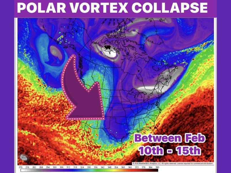
Polar Vortex Collapse Signals Another Wave of Arctic Air for the Lower 48 Between February 10 and 15, With Winter Weather Risks Increasing Again
UNITED STATES — Confidence is growing among forecasters that a polar vortex collapse is underway, setting the stage for another surge of Arctic air across the lower 48 states later in February. Extended-range data now supports a 40% confidence level that this developing pattern will bring renewed winter weather potential after a brief warm-up period.
The event is tied to a confirmed sudden stratospheric warming (SSW) episode, similar to what occurred in mid-November. These upper-atmosphere disruptions typically take two weeks or more to work their way down from the stratosphere into the mid-latitudes and eventually reach the surface.
Why This Polar Vortex Event Is Different
Unlike weaker disruptions, this event shows signs of the polar vortex splitting and collapsing, a scenario that often produces sharper and more disruptive cold outbreaks. Historical patterns suggest these events tend to unfold in three distinct waves, rather than a single cold blast.
A similar setup occurred in early December, when colder-than-normal conditions dominated the first half of the month before a rapid warm-up followed. This time, however, the collapse appears more pronounced, increasing the likelihood of stronger Arctic intrusions.
February 10–15 Marks the First Arctic Push
Current projections indicate the first major impulse of Arctic air could arrive between February 10 and February 15, as polar and subtropical jet streams potentially phase together. When these jets align, the atmosphere becomes more supportive of widespread winter weather setups, including cold outbreaks and storm development.
Forecasters will be closely monitoring how these jet streams interact, as even small shifts can dramatically change where cold air settles and how long it lingers.
Short-Term Warm-Up Before the Pattern Turns Again
Before the next cold wave arrives, much of the lower 48 is expected to rapidly warm, with temperatures rebounding into the 70s by Friday, just in time for Super Bowl weekend. This warming trend is temporary and marks the transition between Arctic waves rather than an end to winter.
As is typical with these patterns, once all three cold waves cycle through, temperatures often rebound sharply upward, leading to a fast and noticeable shift away from winter conditions.
What This Means for the Rest of February
While not every Arctic wave guarantees snow or severe impacts, the second half of February is increasingly likely to trend colder than normal, with elevated risks for winter weather depending on storm timing and jet stream alignment.
Forecasters caution that confidence will continue to evolve, but all signals point to February being highly volatile, featuring sharp temperature swings and rapidly changing conditions.
Stay weather-aware as February unfolds. Follow NapervilleLocal.com for continued updates, long-range pattern tracking, and clear explanations as confidence levels increase and impacts become clearer.

I’ve lived in Naperville long enough to see how quickly our community changes — from new developments downtown to sudden shifts in our Midwest weather. Reporting on Naperville news and daily forecasts gives me the chance to keep neighbors informed about what really matters. My goal is simple: deliver clear, timely updates so you always know what’s happening in our city and what to expect from the skies above.