
Powerful Winter Storm Slams Western U.S. — Washington, Oregon, Idaho, Montana, Utah, Wyoming, and Colorado See Heavy Mountain Snow
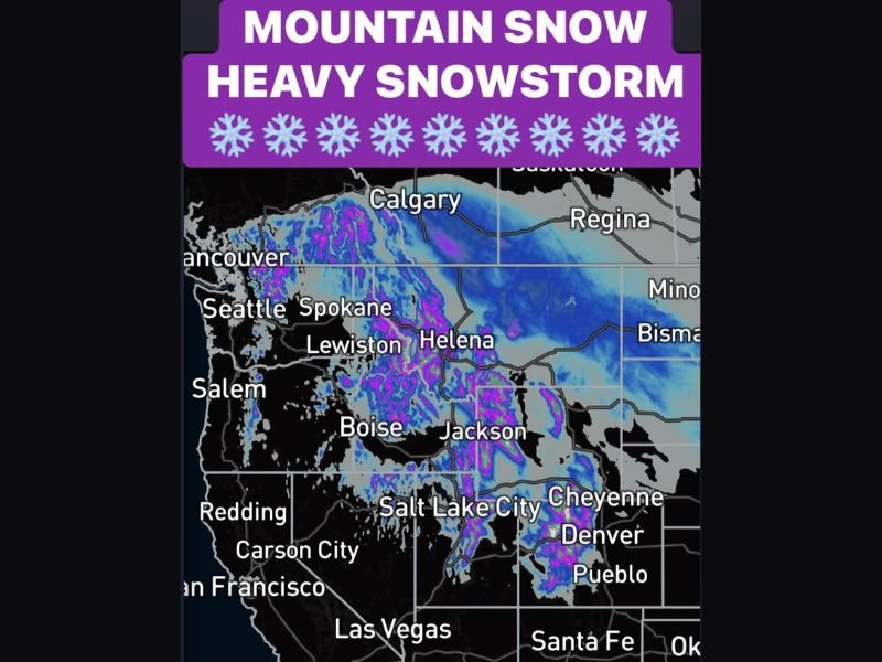
DENVER, COLORADO — A major winter storm system is pounding the western United States this week, dumping 1 to 2 feet of snow across mountain passes from Washington to Colorado and creating treacherous travel conditions across multiple states.
Forecasters say the storm — one of the most widespread early-season systems of the year — is producing rapid snow accumulation, whiteout conditions, and dangerous driving hazards across the Cascades, northern Rockies, and Wasatch mountains.
Washington & Oregon: Cascades Buried Under Heavy Snow
In the Pacific Northwest, the Washington and Oregon Cascades are being hit particularly hard. Snow levels have dropped dramatically, with Snoqualmie Pass (I-90) seeing 8–16 inches and Stevens Pass (US-2) expecting totals of 12–20 inches or more by Thursday night.
Farther south, Oregon’s mountain routes like OR-22 Pass are projected to see 10–18 inches of accumulation, according to early Thursday reports. The National Weather Service (NWS) has warned travelers of “rapidly deteriorating road conditions” and urged them to avoid unnecessary trips.
Idaho & Montana: Near-Blizzard Conditions at High Elevations
Snow is also piling up quickly in Idaho and western Montana, where key travel routes are seeing some of the heaviest totals in the region.
- Lookout Pass (I-90): 12–24 inches or more
- Lolo Pass: 10–18 inches
- Lost Trail Pass: 12–20 inches
Officials have warned that strong winds accompanying the storm could lead to zero-visibility whiteouts, particularly along I-90 near the Montana border. The Montana Department of Transportation reported slick highways and urged commercial drivers to use chains.
Wyoming & Utah: High Winds and Heavy Snow Threaten Canyon Travel
In Wyoming and northern Utah, the storm is producing intense bursts of snow and gusty winds that are complicating canyon travel.
- Teton Pass: 12–20 inches
- Hoback Canyon: 6–12 inches
- Parleys Canyon (I-80 into Salt Lake City): 4–8 inches
- Weber Canyon (I-84): 6–10 inches
The Utah Department of Transportation has warned that conditions may worsen during the morning commute, particularly for those driving between Park City and Salt Lake City.
Colorado Rockies: Travel Near Standstill on Key Passes
In Colorado, snow continues to blanket the Rockies, especially along major mountain passes.
- Vail Pass (I-70): 10–18 inches
- Eisenhower Tunnel (I-70): 8–16 inches
- Rabbit Ears Pass: 12–20 inches
Interstate 70 travelers faced extended delays Thursday morning as plows struggled to keep up with snowfall rates exceeding 2 inches per hour. Officials said traction laws remain in effect for all commercial vehicles.
Meteorologists Warn of “Widespread Hazardous Travel”
Meteorologists say this storm is part of a larger atmospheric trough funneling cold Pacific air into the western U.S., where it’s colliding with moist air masses from the Pacific Ocean. The result: widespread snow across elevations above 3,000 feet and wind chills plunging into the teens.
The National Weather Service offices in Seattle, Boise, and Salt Lake City have all issued Winter Storm Warnings, cautioning drivers about whiteout conditions, rapid freezing on roads, and avalanche potential in steep terrain.
“This is a powerful early-season storm that will likely disrupt mountain travel across multiple states through the end of the week,” said one meteorologist at the NWS Seattle office. “If you’re traveling through the passes, expect slowdowns or closures.”
Outlook: Storm to Continue Through the Weekend
The system is expected to gradually move east by Saturday, with lingering snow showers continuing across Colorado and Wyoming into the weekend. While lower valleys will see lighter accumulations, high mountain regions could end up with 2 to 3 feet of snow by Sunday morning.
Officials across the affected states continue to advise caution for mountain travelers, with chain requirements, avalanche advisories, and freezing temperatures expected to persist.
Stay tuned to NapervilleLocal.com for updates on the Western winter storm and additional state-by-state forecasts.

I’ve lived in Naperville long enough to see how quickly our community changes — from new developments downtown to sudden shifts in our Midwest weather. Reporting on Naperville news and daily forecasts gives me the chance to keep neighbors informed about what really matters. My goal is simple: deliver clear, timely updates so you always know what’s happening in our city and what to expect from the skies above.