
South Carolina Lowcountry Under Extreme Cold Watch as Wind Chills Plunge Into Single Digits This Weekend
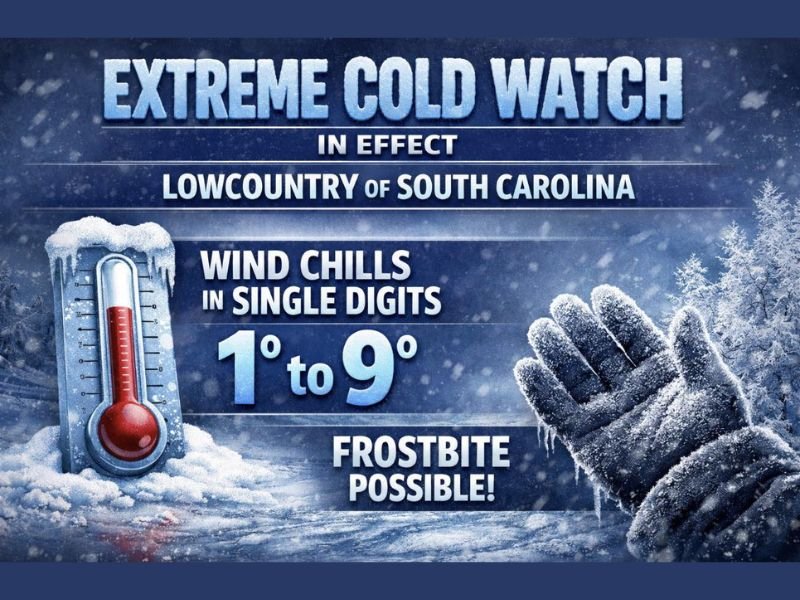
SOUTH CAROLINA — An Extreme Cold Watch has been issued for the Lowcountry of South Carolina, signaling a potentially dangerous cold outbreak from Saturday evening through Sunday morning as Arctic air surges into the region.
Forecasters warn that temperatures will fall sharply overnight, with actual air temperatures dropping into the teens and 20s, while wind chill values fall into the single digits, creating conditions capable of causing frostbite with prolonged exposure.
What the Extreme Cold Watch Means
The Extreme Cold Watch highlights a combination of hazards expected during the overnight and early morning hours:
- Brutal, dangerous cold conditions
- Wind chills between 1°F and 9°F
- Risk of frostbite, especially for exposed skin
- Snow remains possible, though cold is the primary concern
These conditions are especially concerning for the Lowcountry, where infrastructure, homes, and residents are not typically prepared for prolonged Arctic cold.
Timing of the Coldest Conditions
The most severe cold is expected late Saturday night through early Sunday morning, when winds will be strong enough to dramatically lower feels-like temperatures. Even brief outdoor exposure during this window could become hazardous.
Emergency managers urge residents to take the watch seriously, as wind chill values in the single digits are rare for this region and can quickly lead to cold-related injuries.
Who Is Most at Risk
The dangerous cold poses heightened risks for:
- People without adequate heating
- Outdoor workers
- The elderly and young children
- Pets left outdoors
- Those experiencing homelessness
Residents are encouraged to limit outdoor exposure, bring pets indoors, protect pipes, and ensure vulnerable neighbors are safe.
Bottom Line
This is not a typical Lowcountry cold snap. The combination of teen and 20-degree temperatures with single-digit wind chills creates a situation where frostbite is possible, even in areas accustomed to milder winters.
The Extreme Cold Watch serves as an early warning to prepare now before conditions deteriorate overnight. Updates and potential upgrades to warnings may follow as confidence increases.
For continued updates on significant weather threats affecting communities across the country, stay with NapervilleLocal.com.

I’ve lived in Naperville long enough to see how quickly our community changes — from new developments downtown to sudden shifts in our Midwest weather. Reporting on Naperville news and daily forecasts gives me the chance to keep neighbors informed about what really matters. My goal is simple: deliver clear, timely updates so you always know what’s happening in our city and what to expect from the skies above.