
South Dakota Expands Weather Monitoring Network For Better Forecasting
RAPID CITY, S.D. — South Dakota is making major strides in weather monitoring and forecasting with the expansion of the South Dakota Mesonet, a statewide network of advanced weather stations. By 2027, the system will grow from 40 to 150 sites, with the goal of placing a station within 20 miles of every resident.
Why The Expansion Matters
The Black Hills and surrounding areas are known for their rapidly changing weather, ranging from severe storms and tornadoes to drought conditions and heavy snow. With the new network, stations will report fresh data every five minutes, sending updates directly to the National Weather Service, the U.S. Drought Monitor, and forecasting models used across the country.
“This will improve flood forecasting, drought monitoring, and daily weather predictions,” said Nathan Edwards, operations manager for the South Dakota Mesonet. “Every South Dakotan will see an impact from this. It’ll improve their forecast. It’ll improve things for agriculture.”
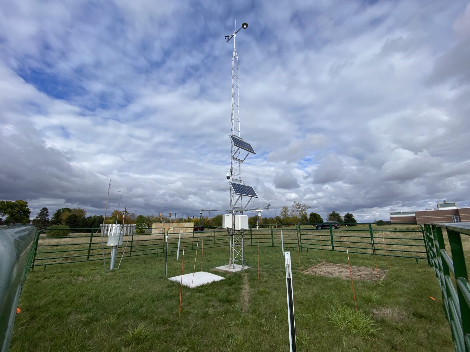
Agriculture And Soil Monitoring
One of the most significant features of the expanded Mesonet is its ability to measure soil moisture and temperature at multiple levels underground. This data is critical for South Dakota’s farming industry, helping growers know when the soil can absorb more water, when runoff is likely, and whether planting conditions are ideal.
The stations will also enhance fire danger monitoring, offering better insights during red flag warnings. Prior to the expansion, less than half of the existing stations had these advanced sensors, limiting the scope of information available.
Severe Weather And Public Access
The system’s cameras allow both researchers and the public to “ground-truth” severe weather in real time. For example, a Mesonet station captured the formation of a tornado near Mound City in August 2024, providing valuable data and imagery to meteorologists.
With more sites being added, residents will be able to access real-time weather data, panoramic views, and time-lapse videos through the network’s public portal. This open access ensures communities can track local weather conditions more closely than ever before.
A Safer Future For South Dakota
The expansion represents a statewide investment in safety, agriculture, and climate preparedness. By combining frequent updates with localized data, forecasters expect stronger accuracy in storm warnings and long-range climate assessments.
As the project progresses, officials say it will make South Dakota one of the most closely monitored weather regions in the country, setting a new model for rural forecasting nationwide.
How do you see this improved forecasting system benefiting your community? Share your thoughts with us at NapervilleLocal.com, where we bring you important updates on weather, safety, and science across the Midwest.

I’ve lived in Naperville long enough to see how quickly our community changes — from new developments downtown to sudden shifts in our Midwest weather. Reporting on Naperville news and daily forecasts gives me the chance to keep neighbors informed about what really matters. My goal is simple: deliver clear, timely updates so you always know what’s happening in our city and what to expect from the skies above.