
Southeast Faces Extended Warm and Dry Pattern With No Snow Signals Showing Over the Next 10 Days
SOUTHEASTERN UNITED STATES – New forecast data shows no meaningful signs of cold air or snow across the Southeast for at least the next 10 days, reinforcing a pattern that continues to favor warm and dry conditions across much of the region. Model guidance indicates that winter weather lovers may need to wait longer, as snowfall potential remains extremely limited through mid-January.
Meteorologists caution against focusing on isolated or dramatic single-model runs circulating on social media, noting that broader data trends do not support a shift toward wintry weather in the near term.
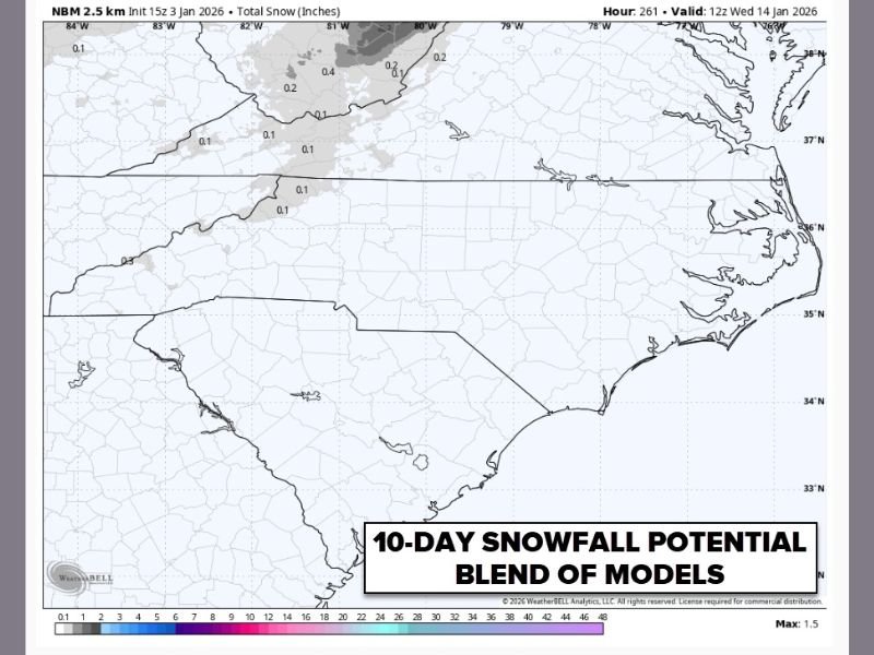
Model Blend Shows Minimal Snow Potential
The 10-day snowfall outlook, based on a blend of multiple weather models, shows little to no accumulated snow across most of the Southeast. Any shaded areas on the map indicate trace or negligible snowfall, not impactful winter weather.
Forecasters emphasize that deterministic, one-off model runs can be misleading, especially when they conflict with ensemble guidance and long-range patterns. Current data continues to favor a suppressed winter signal for the region.
Snow Chances Delayed for the Southeast
While winter is far from over, snow lovers across the Southeast may be waiting longer for a pattern favorable to cold air and storm systems. The current setup lacks the necessary ingredients for snow, including sustained cold air and a storm track positioned far enough south.
Meteorologists note that there is still plenty of winter left, and opportunities for snow could return later in the season if atmospheric patterns change.
Warmth and Dryness Worsening Drought Conditions
The downside to this prolonged warm pattern is its impact on moisture levels. Forecasters warn that ongoing dry weather is contributing to worsening drought conditions across parts of the Southeast.
This stretch has not only been warmer than average but also notably dry, limiting soil moisture recharge and increasing concerns for agriculture and water resources as winter progresses.
Patience Urged as Winter Pattern Evolves
Weather experts stress the importance of monitoring long-term trends rather than reacting to viral forecast graphics. While a cold and snowy pattern is not currently supported, winter can still deliver changes later in January or February.
NapervilleLocal.com will continue tracking national weather patterns and provide updates if signs of colder air or meaningful winter weather begin to emerge for the Southeast or other regions.

I’ve lived in Naperville long enough to see how quickly our community changes — from new developments downtown to sudden shifts in our Midwest weather. Reporting on Naperville news and daily forecasts gives me the chance to keep neighbors informed about what really matters. My goal is simple: deliver clear, timely updates so you always know what’s happening in our city and what to expect from the skies above.