
Texas Cold Front Slams DFW With 30 MPH Winds and Light Freeze Risk as Temperatures Drop 15–20 Degrees This Weekend
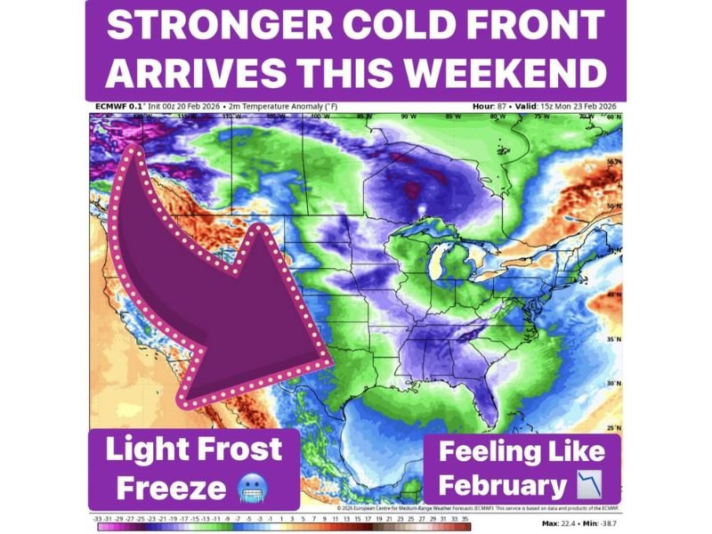
TEXAS — A stronger cold front is sweeping across the state this weekend, bringing a sharp temperature drop, gusty winds up to 30 mph, and the potential for light freeze conditions around the DFW airport and surrounding North Texas communities.
The first front has already arrived, with temperatures falling into the 40s this morning. Afternoon readings are expected to run 15 to 20 degrees cooler than recent days. A reinforcing cold front is forecast to move through Saturday morning, adding stronger winds and setting the stage for a distinctly February-like chill.
Temperatures Turning Much Colder
After the initial front, daytime highs will struggle into the upper 50s this weekend. While that may not sound extreme, it marks a noticeable shift from recent warmth.
The bigger concern comes overnight. Forecast guidance indicates a light freeze risk Sunday morning, particularly in outlying areas outside the urban core. Sunday night could be even colder, with the possibility of upper 20s in some locations. A light freeze is now possible at DFW airport Sunday night, signaling that the cold air mass will be strong enough to reach deeper into the metro.
These temperature levels are sufficient to cause frost formation, potentially impacting early vegetation and outdoor plants.
Wind and Reinforcing Cold Air
The second front arriving Saturday morning is expected to bring winds near 30 mph, which will make the air feel colder than the thermometer suggests. Gusty conditions can increase discomfort, especially for outdoor activities, and raise short-term heating demand across the region.
This reinforcing push of colder air ensures that Sunday will remain chilly rather than quickly rebounding.
Freeze Risk and Planting Reminder
Forecasters are cautioning residents not to assume spring has arrived. Even if temperatures warm back into the 80s next week, another cold front like this could still arrive in March.
The upcoming freeze potential highlights the risk of planting too early. Temperatures in the upper 20s to low 30s can damage sensitive plants and newly planted vegetation. For North Texas residents, the key window to monitor will be Sunday morning and Sunday night, when freeze conditions are most likely.
As this stronger cold front settles in, Texans should prepare for gusty winds, colder afternoons, and the possibility of frost before warmer weather attempts a comeback next week. For continued regional weather coverage and timely updates, visit NapervilleLocal.com.

I’ve lived in Naperville long enough to see how quickly our community changes — from new developments downtown to sudden shifts in our Midwest weather. Reporting on Naperville news and daily forecasts gives me the chance to keep neighbors informed about what really matters. My goal is simple: deliver clear, timely updates so you always know what’s happening in our city and what to expect from the skies above.