
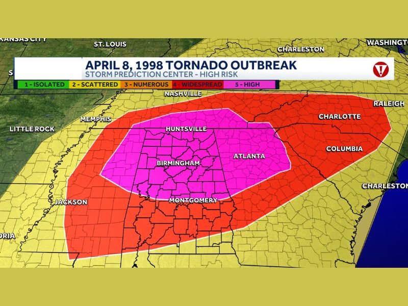
Today: April 8 Reminder Highlights Alabama’s Historic High Risk Tornado Day While No Immediate Severe Threat Expected Across the South
ALABAMA — April 8 serves as a powerful reminder of one of the most significant severe weather days in Alabama history, particularly across Jefferson County, where a devastating tornado event in 1998 left a lasting impact, even as current forecasts show no comparable high-end threat developing across the region in the coming days.
April 8, 1998 Marked by a Single Devastating Tornado
On this day in 1998, a rare “High Risk” outlook was issued, signaling the highest level of severe weather concern. That day was defined by one dominant, long-track supercell that produced a catastrophic F5 tornado.
The tornado carved a destructive path through communities including Oak Grove, Concord, Pleasant Grove, and Edgewater, becoming a singular and focused disaster that shaped how many remember severe weather in Alabama.
High Risk Does Not Always Mean the Same Type of Event
While a High Risk outlook represents the highest level of concern, not all such days unfold the same way.
Some events, like April 8, 1998, are driven by one powerful, long-lasting storm, while others can involve widespread outbreaks with numerous tornadoes occurring across multiple states.
Understanding this difference is key, as the atmosphere can produce danger in very different forms even under the same risk category.
Comparison to More Widespread Outbreak Events
In contrast to 1998, other High Risk days—such as late April 2011—featured widespread and prolonged tornado outbreaks, with multiple violent tornadoes occurring over large areas.
Those events involved numerous storms rather than a single dominant one, showing how variable severe weather setups can be even at the highest risk level.
Most High Risk Days Feature Limited but Intense Storms
Historically, many High Risk days in Alabama tend to resemble the 1998 event more than large-scale outbreaks. They often produce one or two extremely intense storms capable of causing significant damage, rather than dozens of simultaneous tornadoes.
No Similar Setup Expected in the Next 7 to 10 Days
The encouraging takeaway is that current forecast trends do not indicate a similar high-end severe weather setup developing across the South in the next 7 to 10 days.
While it remains the peak of tornado season, the atmosphere is not currently showing signs of producing a major outbreak or a singular high-impact storm in the immediate future. Stay with NapervilleLocal.com for the latest weather updates and local forecast coverage.

I’ve lived in Naperville long enough to see how quickly our community changes — from new developments downtown to sudden shifts in our Midwest weather. Reporting on Naperville news and daily forecasts gives me the chance to keep neighbors informed about what really matters. My goal is simple: deliver clear, timely updates so you always know what’s happening in our city and what to expect from the skies above.