
Wall Cloud Spotted South of Lakeview, Texas as Storm Chasers Track Potential Tornadic Development in the Texas Panhandle
Lakeview, Texas — Storm observers and weather trackers reported a developing wall cloud south of Lakeview in the Texas Panhandle, raising concerns that a severe thunderstorm in the region may be showing early signs of possible tornado development.
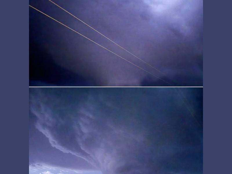
Images captured while tracking the storm show a large rotating cloud base lowering beneath a powerful thunderstorm, a structure meteorologists often associate with supercell storms capable of producing tornadoes.
Weather watchers monitoring the situation say the storm system was actively being tracked in real time, with the wall cloud forming beneath a broad thunderstorm structure as it moved through the area south of Lakeview.
What a Wall Cloud Means During Severe Storms
A wall cloud forms when a portion of a thunderstorm’s base lowers and begins to rotate due to strong atmospheric wind shear and rising warm air.
These formations often appear as dark, rotating cloud structures that extend downward from the storm base, and they are commonly associated with supercell thunderstorms, the type of storm most capable of producing tornadoes.
Meteorologists explain that while not every wall cloud produces a tornado, the feature is considered an important visual indicator that the storm has strong rotating updrafts. When these rotating updrafts intensify, they can occasionally tighten and form a tornado beneath the wall cloud.
Storm Structure Shows Classic Supercell Characteristics
The cloud structure captured south of Lakeview shows broad storm rotation and layered cloud bands feeding into the lowering cloud base, both signs that the thunderstorm may be developing organized rotation. These storm structures typically occur when warm, unstable air rises rapidly into cooler air aloft, creating powerful thunderstorm updrafts.
In environments with strong wind shear, these updrafts can begin rotating and form the distinctive supercell structure seen in severe storms across the Plains. The Texas Panhandle frequently experiences these storm types during periods of active severe weather across the central United States.
Why Storm Chasers Monitor Wall Clouds Closely
Storm chasers and meteorologists often track wall clouds carefully because they can signal rapid changes in storm intensity. If a wall cloud begins to rotate more quickly or descend closer to the ground, it may indicate that tornadogenesis — the formation of a tornado — could be possible.
In many cases, weather radar is used alongside visual observations to confirm whether the storm is producing rotation strong enough to trigger warnings. Although no confirmed tornado was reported at the time of the observation, the storm’s structure prompted close monitoring by weather observers tracking the system in the Texas Panhandle.
Severe Storms Common Across the Texas Panhandle
The region surrounding Lakeview and the Texas Panhandle is known for experiencing strong thunderstorms during periods of unstable weather across the Plains.
When warm, moist air from the south collides with cooler air moving across the region, powerful thunderstorms can rapidly develop, sometimes producing large hail, damaging winds, and tornadoes. Meteorologists continue to watch storms across the region closely as weather conditions evolve.
Residents in areas experiencing severe storms are encouraged to remain weather aware and monitor official alerts, especially when rotating storms or wall cloud formations are observed. For continuing updates on severe weather events and developing storm activity across the United States, readers can follow the latest weather coverage and reports on NapervilleLocal.com.

I’ve lived in Naperville long enough to see how quickly our community changes — from new developments downtown to sudden shifts in our Midwest weather. Reporting on Naperville news and daily forecasts gives me the chance to keep neighbors informed about what really matters. My goal is simple: deliver clear, timely updates so you always know what’s happening in our city and what to expect from the skies above.