
Western North Carolina and East Tennessee Mountains Under Winter Storm Warning as Heavy Snow Targets High Elevations Tonight
Western North Carolina and East Tennessee — A high-impact mountain winter storm is unfolding tonight, with heavy snow rapidly developing across the higher elevations of Western North Carolina and eastern Tennessee, particularly in the Great Smoky Mountains. Meteorologists warn that snowfall rates could reach or exceed one inch per hour, creating dangerous and potentially near-whiteout travel conditions in the highest terrain. The event is fast-moving but intense, with impacts strongly dependent on elevation.
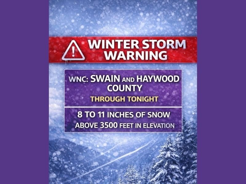
Winter Storm Warning in Effect for Mountain Counties
A Winter Storm Warning has been issued for parts of Western North Carolina, including Swain and Haywood counties, where the most significant impacts are expected. Forecast data indicates:
- 8 to 11 inches of snow possible
- Greatest totals above 3,500 feet in elevation
- Snowfall concentrated in a short overnight window
The warning highlights the risk of rapidly deteriorating road conditions, especially along mountain passes and higher-elevation roadways.
Smokies and High Ridges Face the Greatest Risk
The Great Smoky Mountains are expected to take the brunt of the storm, with heavy, wind-driven snow blasting exposed ridges and peaks. Gusty winds combined with intense snowfall rates may lead to blowing snow and sharply reduced visibility, making travel extremely difficult or impossible at times. Communities and recreation areas above 3,500 feet, including higher mountain roads and ski-area access routes, are most vulnerable to hazardous conditions.
Lower Elevations See Lighter Snow or Dusting
While the highest elevations will see significant accumulation, lower elevations near the Tennessee border could still pick up 1 to 3 inches of snow. In contrast, cities such as Asheville and Hendersonville are expected to see snowflakes flying, but accumulations should remain limited to a dusting up to around a half inch. Forecasters emphasize that small elevation changes will make a big difference in how much snow falls.
Storm Moves Quickly, Travel Impacts Remain Serious
This system is moving fast, but its intensity means impacts could escalate quickly once snowfall begins. Drivers traveling through the mountains tonight should be prepared for:
- Rapidly changing road conditions
- Snow-covered and slick roads above 3,000–3,500 feet
- Sudden visibility reductions due to heavy snow bursts
Officials advise avoiding unnecessary travel in higher elevations until conditions improve.
Watching a Separate Coastal System Later This Weekend
Beyond tonight’s mountain storm, forecasters are also monitoring a separate weather system that could develop Sunday morning along the Carolina and Georgia coastlines. While details remain uncertain, this setup is being watched closely as it evolves.
NapervilleLocal.com will continue providing accurate, location-specific national weather coverage, clearly distinguishing between high-impact mountain events and lower-risk areas.

I’ve lived in Naperville long enough to see how quickly our community changes — from new developments downtown to sudden shifts in our Midwest weather. Reporting on Naperville news and daily forecasts gives me the chance to keep neighbors informed about what really matters. My goal is simple: deliver clear, timely updates so you always know what’s happening in our city and what to expect from the skies above.