
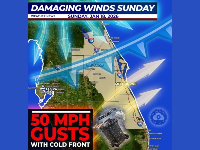
Florida Braces for Damaging 50 MPH Wind Gusts Sunday as Arctic Cold Front Slams Through Central and Coastal Areas
FLORIDA — A powerful Arctic cold front is set to surge across the state on Sunday, bringing roaring wind gusts that could reach 50 mph, especially across Central Florida, before ushering in much colder air and biting wind chills by daybreak Monday.
Meteorologists say this system will be fast-moving but aggressive, with peak wind impacts expected around midday Sunday, followed by a rapid temperature drop behind the front.
Damaging Winds Peak Midday Sunday Across Central Florida
Forecast guidance shows a broad corridor of strong to damaging winds developing from the Tampa Bay area through Orlando and toward the Space Coast, including Melbourne and surrounding coastal communities.
Wind gusts are expected to:
- Peak near 50 mph in exposed areas
- Be strongest during the late morning through mid-afternoon hours
- Easily knock over unsecured objects, trash bins, and lightweight outdoor furniture
Residents are urged to tie down or bring inside anything that could become airborne, as sudden gusts may arrive with little warning.
Arctic Cold Front Brings Sharp Temperature Drop Behind the Winds
The wind event is directly tied to an Arctic cold front charging into Florida with little resistance. Once the front passes, winds will shift and colder air will spill south rapidly.
By early Monday morning:
- Wind chills will feel significantly colder than recent days
- Overnight temperatures will fall quickly behind the front
- The blustery conditions will make the cold feel more intense, especially before sunrise
Meteorologists describe this as a classic frontal surge, where strong pressure differences drive high winds ahead of a sharp temperature decline.
Coastal and Inland Areas Both at Risk for Wind Impacts
While coastal regions may experience the strongest sustained winds, inland communities are not immune. The broad wind field shown on forecast maps indicates that both coastal and interior Florida will see hazardous gusts, particularly near major population corridors and highways. Driving conditions could be affected for high-profile vehicles, and brief power disruptions are possible where gusts peak.
What Residents Should Do Before Winds Increase
With timing well defined, now is the window to prepare:
- Secure outdoor furniture, trash cans, and decorations
- Use caution when driving, especially in open areas
- Plan for colder conditions Sunday night into Monday morning
This system is expected to move through quickly, but its impacts could be felt statewide during the peak wind window on Sunday.
Stay informed as conditions evolve and continue following weather updates through NapervilleLocal.com, where we track developing systems, breaking forecasts, and what they mean for communities across the country.

I’ve lived in Naperville long enough to see how quickly our community changes — from new developments downtown to sudden shifts in our Midwest weather. Reporting on Naperville news and daily forecasts gives me the chance to keep neighbors informed about what really matters. My goal is simple: deliver clear, timely updates so you always know what’s happening in our city and what to expect from the skies above.