
Dallas–Fort Worth Area Under Saturday Severe Storm Threat With Large Hail, Damaging Winds and Flooding Risk Along Stalled Front in Texas
TEXAS — A growing severe weather threat is taking shape for Saturday across parts of north and central Texas, where forecasters have added a risk area along a stalled frontal boundary expected to spark multiple rounds of strong to severe thunderstorms.
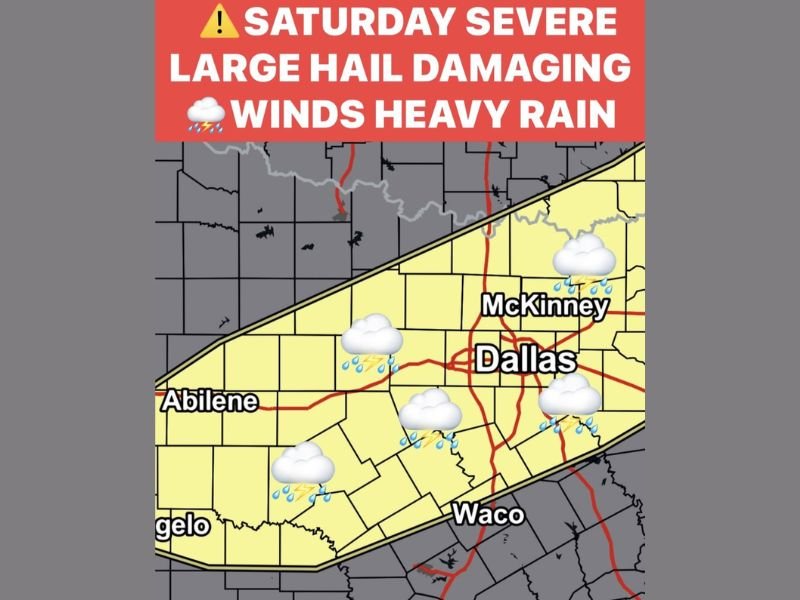
The highlighted corridor includes Dallas, McKinney, Abilene and Waco, with storms capable of producing large hail, damaging winds and heavy rainfall. The setup suggests repeated development along the same boundary, raising concerns about localized flooding as rainfall accumulates through the day.
Stalled Front Sets the Stage for Repeated Storms
The severe risk has been introduced along a frontal boundary expected to stall across portions of north Texas. When a front slows or stalls, it can act as a focus for repeated thunderstorm development, especially when warm, moist air continues feeding into the region.
This type of pattern often results in multiple storm rounds rather than a single fast-moving line. That increases both the severe weather threat and the potential for heavy rain totals.
Cities including Dallas and McKinney sit near the center of the highlighted zone, while Abilene to the west and Waco to the south are also within the area of concern.
Large Hail and Damaging Winds Primary Concerns
The primary hazards Saturday appear to be large hail and damaging straight-line winds. Strong updrafts within developing storms can support significant hail production, especially when atmospheric instability combines with sufficient wind shear.
Wind damage is also possible as storms organize and produce stronger downdrafts. Residents in the risk zone should be prepared for the possibility of rapidly changing conditions, particularly during the afternoon and evening hours.
Heavy Rain Raises Flooding Potential
Beyond severe storm hazards, heavy rainfall is likely to become an increasing concern. With a stalled boundary in place, thunderstorms may repeatedly move over the same areas, leading to locally high rainfall totals.
If storms train over urban areas such as Dallas, localized flooding could develop quickly. Low-lying areas and poor drainage zones would be most vulnerable should rainfall rates intensify.
Busy Stretch of Severe Weather
Saturday is not the only day featuring storm chances. Severe potential has also been noted earlier in the week, including Wednesday and Friday evening, making this a particularly active stretch of weather for Texas.
When multiple disturbances interact with a lingering boundary, the atmosphere can remain primed for additional storm development over several days. That increases the importance of staying alert to updated forecasts as details become clearer.
Residents across north and central Texas, especially in and around Dallas, McKinney, Abilene and Waco, should monitor local forecasts closely and review severe weather safety plans before storms arrive.
For continuing updates on developing severe weather patterns and regional impacts, visit NapervilleLocal.com for the latest coverage.

I’ve lived in Naperville long enough to see how quickly our community changes — from new developments downtown to sudden shifts in our Midwest weather. Reporting on Naperville news and daily forecasts gives me the chance to keep neighbors informed about what really matters. My goal is simple: deliver clear, timely updates so you always know what’s happening in our city and what to expect from the skies above.