
Freezing Rain Threat Across Northern New England: Slick Overnight Conditions Expected From Montreal and Ottawa Toward Maine and New Brunswick
NORTHERN NEW ENGLAND — A surge of moisture moving across parts of eastern Canada and the northeastern United States could bring slick travel conditions overnight as mist and freezing rain spread into northern New England. Meteorologists warn that while ice accumulation may remain relatively light, the combination of moisture and temperatures dropping below freezing could create hazardous glazing on roads and surfaces.
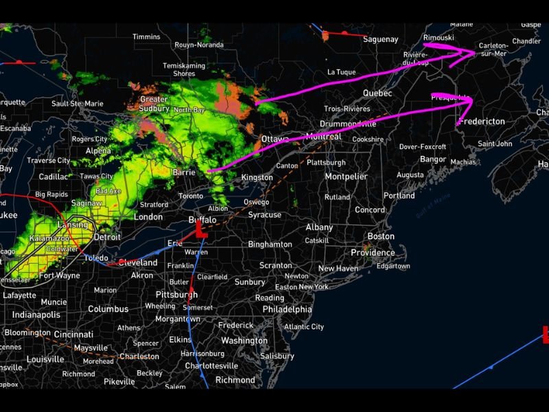
The weather system is moving east from areas around Ontario and Quebec toward Maine and New Brunswick, carrying a band of precipitation that could increase icing concerns during the overnight and early morning hours.
Moisture Already Creating Slick Conditions
Weather experts say the air across much of the region has already become extremely moist, producing a light mist in several areas.
When surface temperatures fall below freezing, this moisture can freeze on contact with roads, sidewalks, vehicles, and other surfaces. Even a small amount of freezing drizzle or mist can create dangerous travel conditions.
Meteorologists note that actual ice accumulation may remain limited, but even a thin glaze can make roads unexpectedly slippery.
Rain and Freezing Rain Moving Into Northern New England
As the night progresses, a larger area of precipitation is expected to push eastward from Ontario into Quebec and toward northern New England.
This band of precipitation could bring rain mixed with freezing rain, especially in areas where temperatures remain at or below the freezing mark.
Cities and communities in northern Maine and surrounding areas of northern New England may see icing conditions worsen briefly before temperatures rise later in the day.
Icing Could Peak Before Morning Warmup
Forecasters say the highest icing risk will likely occur late tonight through the early morning hours when temperatures are most likely to be below freezing.
As daylight arrives, temperatures are expected to climb well above freezing across many areas, which should gradually improve road conditions and melt any thin glaze of ice. Because the icing window may be relatively short, the most dangerous travel conditions could occur before sunrise.
Warmer Temperatures Expected After the System Passes
Once the system moves through the region, temperatures are expected to moderate, reducing the risk of additional icing through the weekend. Meteorologists say widespread subfreezing temperatures are unlikely after this event, though isolated colder pockets could still occur until early next week.
Residents across northern New England are encouraged to remain cautious overnight and during the early morning commute as freezing drizzle and light freezing rain may briefly create slick roads and walkways.

I’ve lived in Naperville long enough to see how quickly our community changes — from new developments downtown to sudden shifts in our Midwest weather. Reporting on Naperville news and daily forecasts gives me the chance to keep neighbors informed about what really matters. My goal is simple: deliver clear, timely updates so you always know what’s happening in our city and what to expect from the skies above.