
Ohio Windstorm Slams Upper Sandusky as 70 MPH Gusts Flip Semis and Shut Down US-23 With Widespread Highway Damage
UPPER SANDUSKY, OHIO — A powerful windstorm tore across Ohio, producing extreme gusts strong enough to flip semi-trucks, damage roofs, and shut down major highways. Officials say peak wind gusts between 65 and 70 miles per hour were reported across parts of the state, creating dangerous travel conditions and widespread disruptions.
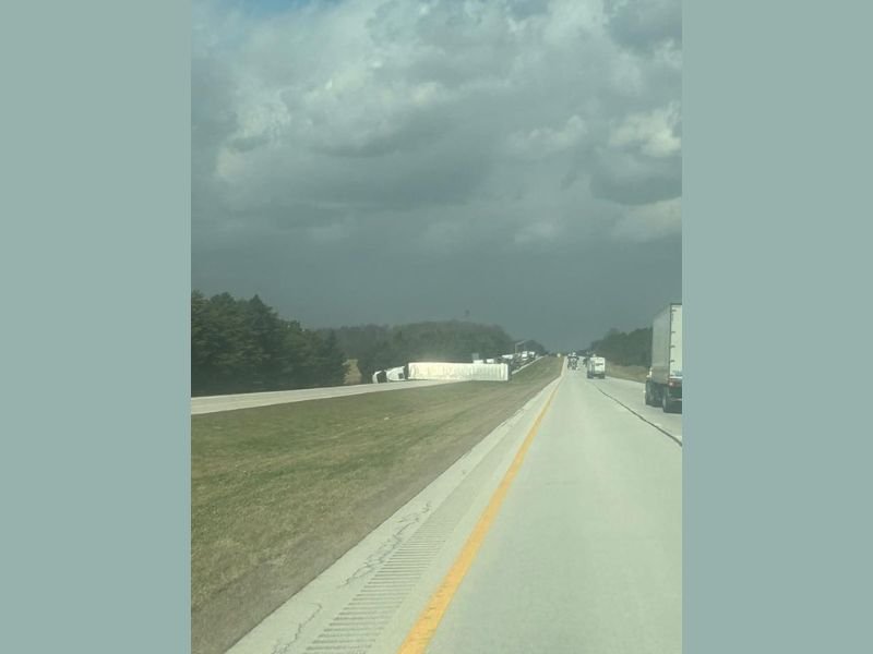
One of the most dramatic scenes occurred near Upper Sandusky, where strong winds overturned several tractor-trailers along U.S. Route 23, forcing authorities to shut down the southbound lanes.
Semi Trucks Overturned on U.S. 23 Near Upper Sandusky
The intense windstorm caused hazardous conditions along highways throughout Ohio, but the situation near Upper Sandusky quickly became one of the most serious incidents.
Photos taken along US-23 southbound showed multiple semi-trailers tipped onto their sides along the highway shoulder. The dangerous conditions forced officials to temporarily close the roadway as emergency crews responded to the scene. Strong crosswinds are especially dangerous for high-profile vehicles like tractor-trailers, which can be pushed over when gusts exceed 60 mph.
Several Major Highways Report Wind Damage
Beyond the shutdown near Upper Sandusky, reports of wind-related incidents surfaced along several other highways throughout the state.
Drivers reported issues along:
- Interstate 75
- Interstate 20
- State Route 280
- Interstate 475
Authorities believe additional incidents may have occurred throughout the day as strong winds continued to sweep across the region. Meteorologists say the storm produced widespread gusts exceeding 50 mph, with stronger bursts reaching the 65–70 mph range in some locations.
One of the Windiest Days in Local Ohio Weather History
Weather observers described the event as one of the most intense wind days many residents have experienced in recent years. Reports of damage ranged from overturned trucks to roofing materials being torn from buildings and scattered debris across roadways.
Powerful wind events like this often occur when a strong pressure gradient develops across the Midwest, allowing sustained winds and sudden gusts to rapidly intensify.
Dangerous Winds Continued Through the Afternoon
Even after the strongest gusts occurred, winds across Ohio remained powerful through the afternoon hours. Meteorologists warned that gusts over 50 mph could continue for several more hours before gradually weakening into the evening. Those conditions continued to pose risks for drivers, particularly along open highways and rural roads where wind exposure is greater.
Drivers Urged to Use Extreme Caution
Officials urged motorists to remain cautious while traveling during the windstorm, especially drivers of large vehicles such as semi-trucks, buses, and recreational vehicles. High-profile vehicles are significantly more vulnerable to strong crosswinds, which can quickly destabilize trailers traveling at highway speeds.
Authorities say road crews and emergency responders will continue monitoring highways across Ohio as winds gradually decrease and cleanup efforts begin following the powerful wind event.

I’ve lived in Naperville long enough to see how quickly our community changes — from new developments downtown to sudden shifts in our Midwest weather. Reporting on Naperville news and daily forecasts gives me the chance to keep neighbors informed about what really matters. My goal is simple: deliver clear, timely updates so you always know what’s happening in our city and what to expect from the skies above.