
Heavy Snow Up to 2 Feet, Travel Impacts and Power Outages Targeting Colorado Including Denver, Palmer Divide and Front Range Monday Through Wednesday With Rain to Snow Changeover Tuesday Night
COLORADO — A significant and multi-day precipitation event is unfolding across Colorado from Monday through Wednesday, May 4 to 6, 2026, bringing heavy mountain snow, travel impacts, and power outage potential across a wide area. A cold front dropping in Monday afternoon kicks off the event, with showers and storms ramping up after 1 to 2 PM north of I-70. Tuesday is when things organize fully, with the most impactful precipitation window running Tuesday afternoon into Wednesday morning.
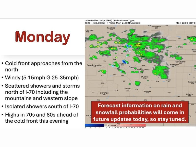
Monday Brings Cold Front, Scattered Storms and Snow Levels Dropping to 6000 Feet
Showers and thunderstorms develop Monday after 1 to 2 PM along and north of I-70, covering the mountains, Front Range, northeast Plains, and southeast Wyoming. South of I-70 activity stays more isolated through the day.
Snow levels drop to around 6,000 feet tonight, bringing snow periods to the foothills west of I-25, central and northern mountains, and along Cheyenne Ridge near I-80. Winds gust 25 to 35 mph statewide with highs in the 70s and 80s ahead of the front.
Tuesday Organizes Into Widespread Rain and Snow With Travel Impacts Above 6000 Feet
Tuesday brings widespread precipitation filling in across the mountains, foothills, Front Range, I-25 corridor, and eastern Plains north of I-70 first before spreading south. Below 6,000 feet, rain may briefly mix with or change to wet snow with accumulation mainly on grassy surfaces.
Above 6,000 feet, travel impacts become likely with significant snow accumulations. Above 8,000 feet carries high probability of 1 foot plus and low to medium probability approaching 2 feet, with Park, Jefferson, Boulder, Gilpin, and Larimer Counties seeing the best chances.
Snow Totals Range From 1 to 5 Inches in Denver to 6 to 12 Inches Across Teller and Park Counties
Denver metro and northern Front Range are looking at 1 to 5 inches through Wednesday afternoon with upside potential exceeding 5 inches. Teller and Park Counties carry 6 to 12 inches as a solid forecast, with Woodland Park potentially exceeding 12 inches.
Palmer Divide sits at 3 to 8 inches currently, with upside above 8 inches not out of the question. Northern El Paso County including Black Forest is forecast at 3 to 8 inches with additional upside potential through the event. Stay with NapervilleLocal.com for the latest weather updates and local forecast coverage.

I’ve lived in Naperville long enough to see how quickly our community changes — from new developments downtown to sudden shifts in our Midwest weather. Reporting on Naperville news and daily forecasts gives me the chance to keep neighbors informed about what really matters. My goal is simple: deliver clear, timely updates so you always know what’s happening in our city and what to expect from the skies above.