
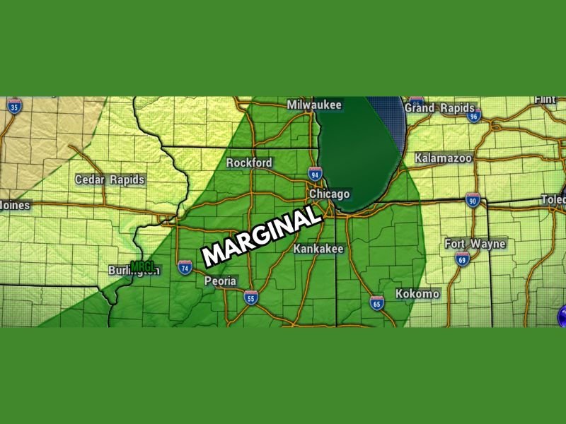
Hail and Gusty Winds Possible Across Illinois Stateline Including Rockford Chicago and Kankakee Under Marginal Risk Tuesday Into Tuesday Night
ILLINOIS — A Level 1 Marginal Risk for severe weather is in place across much of the Illinois Stateline region for Tuesday and Tuesday night, with hail and gusty winds the primary hazards tied to any stronger storms that develop. The threat window spans the afternoon through evening hours, but two key atmospheric factors are significantly limiting how aggressive this setup can become. While severe weather cannot be completely ruled out, confidence is growing that the region may largely dodge the worst of it.
Limited Moisture Is the First Major Factor Keeping This Threat in Check
Dew points across the Stateline are expected to barely climb into the 50s on Tuesday, well short of the 60s threshold typically needed to fuel a legitimate severe weather setup this time of year. Temperatures will have no trouble reaching the mid to upper 70s, but without adequate moisture, the atmosphere simply lacks the energy needed for storms to intensify to significant levels.
That gap between warm temperatures and low dew points represents a meaningful cap on storm potential. The energy source that severe thunderstorms depend on will be limited, which reduces the overall ceiling for what any storms Tuesday can actually produce.
Early Frontal Passage Is the Second Reason the Threat Stays Limited
The timing of the cold front is working against storm development as well. The front is currently forecast to push through the Stateline region sometime during the early to mid-afternoon hours, well before the atmosphere has enough time to fully charge up and destabilize.
Had the front held off until dinnertime or later, especially with any sunshine helping to energize the atmosphere beforehand, the setup would look considerably more concerning. Instead, the earlier passage cuts off the storm development window and further limits the available energy for storms to feed on.
Hail and Gusty Winds Remain Possible With Any Stronger Storms Tuesday Afternoon and Evening
Despite the limiting factors, the Marginal Risk designation means hail and damaging gusts cannot be ruled out entirely if a stronger storm manages to develop during the afternoon or evening. The Chicago, Rockford, and Kankakee areas all fall within the outlined risk zone and should remain weather-aware throughout the day.
Anyone with outdoor plans Tuesday afternoon or evening should keep an eye on radar and have a way to receive alerts. The threat is low but not zero, and conditions should be monitored as the front approaches the region. Stay with NapervilleLocal.com for the latest weather updates and local forecast coverage.

I’ve lived in Naperville long enough to see how quickly our community changes — from new developments downtown to sudden shifts in our Midwest weather. Reporting on Naperville news and daily forecasts gives me the chance to keep neighbors informed about what really matters. My goal is simple: deliver clear, timely updates so you always know what’s happening in our city and what to expect from the skies above.