
Flash Flood Watch With 3 to 4 Inch Rainfall Totals Possible Across Metro Atlanta and Northwest Georgia Including Rome Canton and Gainesville Until 9 PM Monday
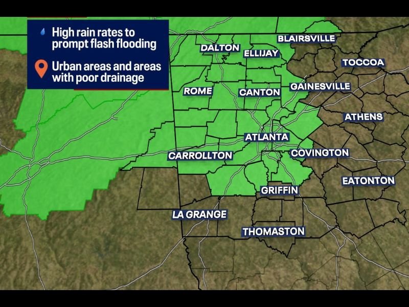
METRO ATLANTA AND NORTHWEST GEORGIA — A Flood Watch is in effect for Metro Atlanta and Northwest Georgia until 9 PM Monday evening, with isolated rainfall totals potentially reaching 3 to 4 inches as an incredibly moist environment supports high rain rates across the region through the day. The Flood Watch covers a large swath of communities including Atlanta, Rome, Canton, Gainesville, Dalton, Ellijay, Blairsville, Carrollton, Covington, Griffin, and surrounding areas across the green-shaded zone.
Showers and thunderstorms may repeatedly move over the exact same communities, which can quickly overwhelm the ground and drainage systems.
Repeated Rounds of Heavy Rain Create the Primary Flash Flood Risk
The flash flooding concern is not coming from a single intense storm but rather from multiple rounds of heavy rainfall moving across the same communities throughout the day. An exceptionally moist atmosphere over Georgia is supporting high rainfall rates that can rapidly accumulate in urban areas, locations with poor drainage infrastructure, and along local creeks and streams.
When repeated rounds of heavy rain fall on already saturated ground, flash flooding can develop with little warning even in areas not traditionally prone to flooding issues.
Urban Areas Poor Drainage Spots and Local Streams Most Vulnerable
The Flood Watch specifically highlights urban areas and locations with poor drainage as the most vulnerable zones within the watch area. Atlanta’s dense urban landscape with extensive impervious surfaces means even moderate rainfall rates can quickly produce street flooding and hazardous driving conditions across the metro.
Creeks and streams across northwest Georgia are also at risk of rapid rises that can impact low-water crossings and flood-prone roadways within minutes of heavy rainfall onset.
Never Drive Into Flooded Roadways and Stay Weather Aware Through 9 PM
The Flood Watch remains in effect through 9 PM Monday, meaning the flash flooding risk extends through the entire afternoon and into the early evening hours. Residents across the watch zone are urged to stay weather aware, avoid driving through flooded roadways under any circumstances, and monitor local conditions closely throughout the day.
Turn around, don’t drown applies to every flooded road regardless of how familiar the route may be. Stay with NapervilleLocal.com for the latest weather updates and local forecast coverage.

I’ve lived in Naperville long enough to see how quickly our community changes — from new developments downtown to sudden shifts in our Midwest weather. Reporting on Naperville news and daily forecasts gives me the chance to keep neighbors informed about what really matters. My goal is simple: deliver clear, timely updates so you always know what’s happening in our city and what to expect from the skies above.