
Level 2 Severe Weather Risk Upgraded for Monday Across Charlotte Raleigh and Columbia as Front Approaches Carolinas After Warm Father’s Day
CHARLOTTE, NORTH CAROLINA — Clear skies and warm conditions are in place across the Carolinas this Father’s Day, with highs expected near 90 degrees and only a 20 to 30 percent chance of afternoon and evening thunderstorms. The bigger story is Monday, when an approaching front has prompted an upgraded Level 2 out of 5 severe weather risk across the region.
Storms are expected to become more numerous and energetic Monday afternoon and evening compared to today’s isolated activity. Not everyone will see severe weather, but a few storms could bring strong winds, frequent lightning, and heavy downpours.
Father’s Day Brings Warm and Mostly Dry Conditions
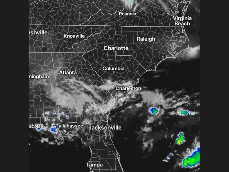
Satellite imagery shows clear skies across much of the Carolinas this morning, with Charlotte, Raleigh, and Columbia all expected to see another warm summer day. Increased atmospheric humidity will allow for a few isolated afternoon and evening thunderstorms, though coverage is expected to remain limited across the region.
Front Approaching for Monday Severe Weather Risk
A frontal boundary moving into the area has led forecasters to upgrade Monday’s severe weather risk to Level 2 out of 5. This upgrade reflects expectations for a more active and energetic storm setup compared to today, with greater coverage of thunderstorms likely.
Strong Winds and Heavy Downpours Possible Monday
While severe weather will not affect everyone in the region, some storms Monday afternoon and evening could produce strong winds, frequent lightning, and locally heavy rainfall. Forecasters say the energy associated with the approaching front will help fuel stronger storm development compared to Sunday’s activity.
Tropical Moisture Lingers Near Florida Coast
Satellite imagery also shows scattered showers and thunderstorms offshore near Jacksonville and Tampa, along with activity near Tallahassee and the Florida Panhandle, though this activity remains well south of the Carolinas and is not expected to impact the upcoming severe weather setup.
Stay with NapervilleLocal.com for the latest weather updates and local forecast coverage.

I’ve lived in Naperville long enough to see how quickly our community changes — from new developments downtown to sudden shifts in our Midwest weather. Reporting on Naperville news and daily forecasts gives me the chance to keep neighbors informed about what really matters. My goal is simple: deliver clear, timely updates so you always know what’s happening in our city and what to expect from the skies above.