
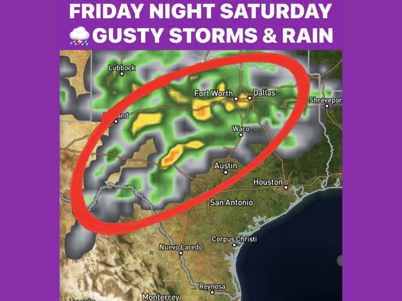
Texas DFW Weather Shift Brings Near-70 Warmth, Then Friday Night Thunder and a Saturday Cool-Front Rain Push
TEXAS — A stretch of unseasonably warm February weather is setting up across North Texas this week, with temperatures running roughly 20 degrees above average before a stronger storm system arrives late Friday and pushes rain through Saturday, according to the forecast details shown in the graphic.
Unseasonable Warmth Leads the Week
The outlook calls for a very warm week ahead, with afternoon temperatures expected to stay well above seasonal norms. The forecast notes that Tuesday’s rain chances look slim, and any rain that does develop Tuesday night is expected to be light (under about a tenth of an inch) with limited overall coverage.
Friday Night: Stronger Disturbance Brings Gusty Storms
A more noticeable weather change is expected Friday night, when a stronger disturbance arrives and increases the chance for thunderstorms overnight. The forecast highlights the potential for rumbles of thunder, gusty winds, and lightning, while also stressing that the storms are expected to remain non-severe during the overnight window.
Saturday: Cool Front Arrives With Rain Into the Afternoon
Forecast details indicate a second piece of energy arrives Saturday with a cool front, bringing a period of rain that could last into Saturday afternoon. Timing is still expected to be refined as the week continues, but the overall message is clear: Saturday turns wetter and cooler compared to the early-week warmth.
Sunday Looks Calmer and Comfortable
After the front moves through, the forecast calls for a dry and sunny Sunday, with temperatures reaching the upper 60s — a quieter finish after the late-week storm chances.
NapervilleLocal.com will continue posting fast, easy-to-read weather updates like this as new forecast graphics and storm timing details come into focus.

I’ve lived in Naperville long enough to see how quickly our community changes — from new developments downtown to sudden shifts in our Midwest weather. Reporting on Naperville news and daily forecasts gives me the chance to keep neighbors informed about what really matters. My goal is simple: deliver clear, timely updates so you always know what’s happening in our city and what to expect from the skies above.