
Today Into Tonight: Beautiful Easter Weather Across Colorado With 60s to Near 70, Then Strong Evening Winds Up to 40 MPH and Changing Conditions Early Week
DENVER, COLORADO — A near-perfect Easter Sunday is unfolding across Colorado, with mild temperatures, light winds, and comfortable conditions making it an ideal day for outdoor plans. Highs are expected to reach into the 60s to near 70 degrees across much of the region, including the Front Range and eastern plains. However, conditions will shift later tonight as stronger winds develop, followed by a more unsettled pattern heading into the new week.
Warm and Pleasant Easter Sunday Across the Region
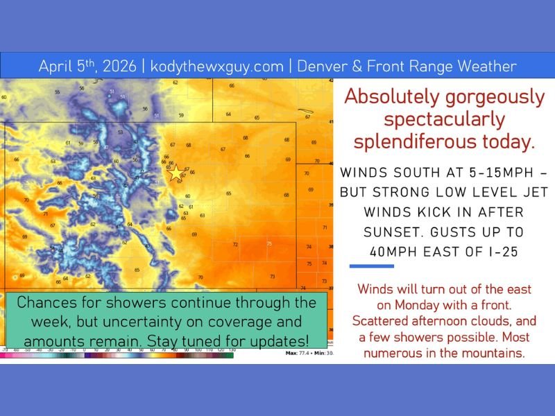
Conditions today are about as good as it gets for early April, with widespread highs in the 60s to near 70 across lower elevations. Areas along the western slope will also enjoy similar mild temperatures, while slightly cooler conditions persist in the mountains.
Winds will remain light and variable through the day, generally between 5 to 15 mph, creating a comfortable and calm atmosphere for outdoor activities.
Winds Increase Tonight With Gusts Over 40 MPH
After sunset, conditions will begin to change as a strengthening low-level jet develops. This will create a noticeable increase in winds, especially east of the I-25 corridor.
Gusts could exceed 40 mph overnight, particularly along the Palmer Divide and nearby areas. These stronger winds may lead to blowing dust and more challenging travel conditions late tonight.
Monday Brings Temperature Divide Across the Region
A front moving into the region on Monday will create a sharp contrast in temperatures. Areas north of I-70, including parts of Wyoming and Nebraska, will see cooler conditions with highs only reaching into the 50s as winds shift easterly.
Meanwhile, southern areas, including parts of western Kansas and southern Colorado, will remain warmer, with temperatures rising into the 70s and possibly approaching 80 degrees.
Mountain Showers and Unsettled Pattern Begins
With the changing pattern, upslope flow and a weak disturbance moving out of the Four Corners region will bring a chance for scattered showers, particularly across the mountains.
Higher elevations above around 11,000 feet could see snow showers, while lower elevations may experience brief rain showers or isolated thunderstorms.
Uncertain Midweek Pattern With More Changes Ahead
Looking ahead, forecast models show increasing uncertainty through midweek. Some scenarios suggest continued showers and storms, while others point toward drier conditions early before activity returns later in the week.
Despite the uncertainty, temperatures are expected to fluctuate but remain generally mild, with no major swings expected. Stay with NapervilleLocal.com for the latest weather updates and local forecast coverage.

I’ve lived in Naperville long enough to see how quickly our community changes — from new developments downtown to sudden shifts in our Midwest weather. Reporting on Naperville news and daily forecasts gives me the chance to keep neighbors informed about what really matters. My goal is simple: deliver clear, timely updates so you always know what’s happening in our city and what to expect from the skies above.